
| Distance / Altitude | Location | Report Date / Time | Live Weather | Wind | Gusts | Temp. | Visibility | Cloud |
|---|---|---|---|---|---|---|---|---|
| 9 km SE / 3 m | SHIP9118 (Marine) | 2025-12-26 08:00 local (2025/12/26 00:00 GMT) | light winds from the NNW (7 km/h at 340) | 27°C | - | |||
| 13 km NNE / 171 m | Paya Lebar Airport (Singapore) | 2025-12-26 08:00 local (2025/12/26 00:00 GMT) | - | calm (4 km/h at 40) | 26°C | 10.0 | few few broken | |
| 17 km N / 172 m | Singapore/Seletar Airport (Singapore) | 2025-12-26 08:00 local (2025/12/26 00:00 GMT) | Dry and partly cloudy | calm (4 km/h at 1) | 26°C | 9.0 | few broken | |
| 19 km NE / 14 m | Singapore-Changi Airport (Singapore) | 2025-12-26 09:00 local (2025/12/26 01:00 GMT) | - | calm (4 km/h at 1) | 27°C | 10.0 | few few broken | |
| 27 km NW / 8 m | Kampung Bakar Batu wx (Malaysia) | 2025-12-26 09:47 local (2025/12/26 01:47 GMT) | - | calm (0 km/h at 112) | 29°C | - | - - 0 | |
| 17 km N / 172 m | Singapore/Seletar Airport (Singapore) | 2025-12-26 08:00 local (2025/12/26 00:00 GMT) | Dry and partly cloudy | calm (4 km/h at 1) | 26°C | 9.0 | few broken | |
| 18 km SW / 15 m | SHIP3676 (Marine) | 2025-12-26 08:00 local (2025/12/26 00:00 GMT) | - (- km/h at -) | — | - km | |||
| 18 km ESE / 15 m | SHIP7582 (Marine) | 2025-12-26 08:00 local (2025/12/26 00:00 GMT) | - (- km/h at -) | — | - km | |||
| 18 km SW / 15 m | SHIP7229 (Marine) | 2025-12-26 08:00 local (2025/12/26 00:00 GMT) | - (- km/h at -) | — | - km | |||
| 18 km ESE / 15 m | SHIP4269 (Marine) | 2025-12-26 08:00 local (2025/12/26 00:00 GMT) | - (- km/h at -) | — | - km |
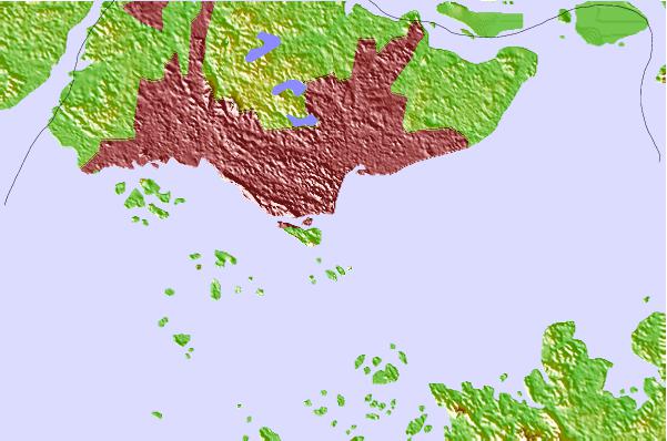
| Contours: | Roads & Rivers: | Select a
tide station / surf break / city |
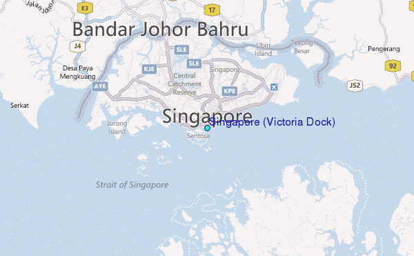
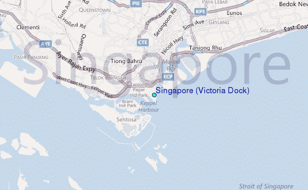
Use this relief map to navigate to tide stations, surf breaks and cities that are in the area of Singapore (Victoria Dock).
Other Nearby Locations' tide tables and tide charts to Singapore (Victoria Dock):
click location name for more details
 Surf breaks close to Singapore (Victoria Dock):
|
||
|---|---|---|
| Closest surf break | Tioman Island | 108 mi |
| Second closest surf break | Cherating | 200 mi |
| Third closest surf break | Kijal | 214 mi |
| Fourth closest surf break | Kelulut (Marang) | 273 mi |
| Fifth closest surf break | Batu Buruk | 285 mi |


 Nearest
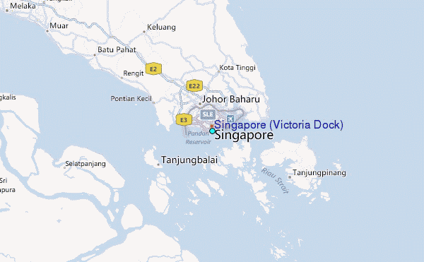