
| Distance / Altitude | Location | Report Date / Time | Live Weather | Wind | Gusts | Temp. | Visibility | Cloud |
|---|---|---|---|---|---|---|---|---|
| 140 km W / 2 m | Juanda Airport (Indonesia) | 2026-03-01 07:30 local (2026/03/01 00:30 GMT) | Clouds developing | light winds from the WSW (9 km/h at 250) | 25°C | 30 km | few mostly cloudy - | |
| 152 km W / 3 m | SurabayaPerakI (Indonesia) | 2026-03-01 07:00 local (2026/03/01 00:00 GMT) | - | calm (4 km/h at 280) | 25°C | 30 km | - mostly cloudy - | |
| 171 km SE / 216 m | Bali International Airport (Indonesia) | 2026-03-01 07:30 local (2026/03/01 00:30 GMT) | Dry and partly cloudy | moderate winds from the W (26 km/h at 270) | 28°C | 10.0 | scattered | |
| 173 km SE / 1 m | DenpasarNgurahRai (Indonesia) | 2026-03-01 07:00 local (2026/03/01 00:00 GMT) | State of sky unchanged | moderate winds from the W (20 km/h at 270) | 28°C | 30 km | overcast | |
| 276 km ESE / 97 m | Bandara Airport (Indonesia) | 2026-03-01 07:30 local (2026/03/01 00:30 GMT) | Dry and partly cloudy | light winds from the WNW (17 km/h at 290) | 27°C | 8.0 | broken | |
| 320 km SSE / 0 m | lightning 193km SSW of Jimbaran (Indonesia) | 2026-03-01 08:03 local (2026/03/01 01:03 GMT) | Thunderstorm | (- km/h at -) | — | |||
| 385 km ESE / 3 m | SumbawaBesarBrangbiji (Indonesia) | 2026-03-01 07:00 local (2026/03/01 00:00 GMT) | - | calm (2 km/h at 120) | 24°C | 29 km | - mostly cloudy - | |
| 389 km SW / 0 m | lightning 124km S of Wonosari (Indonesia) | 2026-03-01 08:16 local (2026/03/01 01:16 GMT) | Thunderstorm | (- km/h at -) | — | |||
| 403 km WSW / 152 m | Bukitsari wx (Indonesia) | 2026-03-01 08:15 local (2026/03/01 01:15 GMT) | - | - (- km/h at ) | 26°C | - | - - 0 | |
| 408 km WSW / 3 m | Achmad Yani (Indonesia) | 2026-03-01 07:00 local (2026/03/01 00:00 GMT) | State of sky unchanged | calm (4 km/h at 90) | 25°C | 26 km | mostly cloudy |
| Contours: | Roads & Rivers: | Select a
tide station / surf break / city |
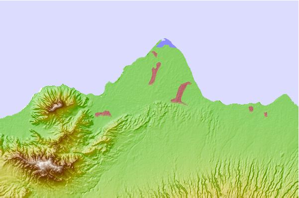
Use this relief map to navigate to tide stations, surf breaks and cities that are in the area of Situbondo.
Other Nearby Locations' tide tables and tide charts to Situbondo:
click location name for more details
 Surf breaks close to Situbondo:
|
||
|---|---|---|
| Closest surf break | Tanjung Kucur | 72 mi |
| Second closest surf break | Grajagan Bay/G-Land | 74 mi |
| Third closest surf break | Medewi | 75 mi |
| Fourth closest surf break | Balian | 86 mi |
| Fifth closest surf break | Pererenan | 101 mi |


 Nearest