
| Distance / Altitude | Location | Report Date / Time | Live Weather | Wind | Gusts | Temp. | Visibility | Cloud |
|---|---|---|---|---|---|---|---|---|
| 41 km S / 56 m | Stenhoej (Denmark and Faroe Islands) | 2026-06-24 19:54 local (2026/06/24 17:54 GMT) | no report | moderate winds from the W (26 km/h at 260) | 15°C | - | - | |
| 64 km ENE / 20 m | Havsporten (Sweden) | 2026-06-24 20:00 local (2026/06/24 18:00 GMT) | - | light winds from the SW (13 km/h at 229) | 20°C | - | - - 0 | |
| 67 km ENE / 12 m | Goteborg (Sweden) | 2026-06-24 18:19 local (2026/06/24 16:19 GMT) | dry | light winds from the SSW (11 km/h at 208) | 20°C | - | - - 0 | |
| 69 km ENE / 50 m | Tjuvkil (Sweden) | 2026-06-24 20:00 local (2026/06/24 18:00 GMT) | - | light winds from the NW (11 km/h at 310) | 23°C | - | - - 0 | |
| 72 km S / 10 m | Tylstrup (Denmark and Faroe Islands) | 2026-06-24 19:53 local (2026/06/24 17:53 GMT) | no report | light winds from the W (7 km/h at 270) | 16°C | - | - | |
| 75 km E / 4 m | GWC (Sweden) | 2026-06-24 20:00 local (2026/06/24 18:00 GMT) | - | moderate winds from the S (20 km/h at 178) | 22°C | - | - - 0 | |
| 76 km NE / 25 m | Röd wx (Sweden) | 2026-06-24 18:25 local (2026/06/24 16:25 GMT) | dry | calm (3 km/h at 154) | 24°C | - | - - 0 | |
| 76 km E / 213 m | Goteborg City Airport (Göteborg-Säve-Airport) (Sweden) | 2026-06-24 19:20 local (2026/06/24 17:20 GMT) | Dry and partly cloudy | light winds from the W (7 km/h at 280) | 21°C | 10.0 | no cloud | |
| 82 km S / 219 m | Alborg Airport (Denmark) | 2026-06-24 19:20 local (2026/06/24 17:20 GMT) | - | moderate winds from the SW (24 km/h at 230) | — | 0.0 | ||
| 83 km S / 13 m | Flyvestation Aalborg (Denmark) | 2026-06-24 19:53 local (2026/06/24 17:53 GMT) | no report | fresh winds from the WSW (31 km/h at 240) | 16°C | 45 | - |
| Contours: | Roads & Rivers: | Select a
tide station / surf break / city |

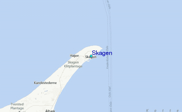
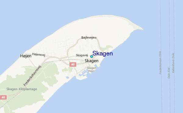
Use this relief map to navigate to tide stations, surf breaks and cities that are in the area of Skagen.
Other Nearby Locations' tide tables and tide charts to Skagen:
click location name for more details
 Surf breaks close to Skagen:
|
||
|---|---|---|
| Closest surf break | Asa | 61 mi |
| Second closest surf break | Appelviken | 75 mi |
| Third closest surf break | Traslovslage | 78 mi |
| Fourth closest surf break | Valnäs - Nord Koster | 83 mi |
| Fifth closest surf break | Glommen | 86 mi |


 Nearest
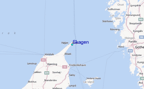