
| Distance / Altitude | Location | Report Date / Time | Live Weather | Wind | Gusts | Temp. | Visibility | Cloud |
|---|---|---|---|---|---|---|---|---|
| 4 km E / 4 m | Seaside Park- NJ (United States) | 2026-07-27 19:00 local (2026/07/27 23:00 GMT) | - | fresh winds from the SSW (33 km/h at 198) | 25°C | - | - - 0 | |
| 15 km W / 25 m | Toms River (New jersey) | 2026-07-27 17:56 local (2026/07/27 21:56 GMT) | Light rain | light winds from the S (13 km/h at 180) | 25°C | 16 | ||
| 35 km ESE / 3 m | Barnegat- NJ (Marine) | 2026-07-27 19:00 local (2026/07/27 23:00 GMT) | - (- km/h at -) | 24°C | - | |||
| 40 km W / 218 m | Wrightst/Mcguire Airport (New Jersey) | 2026-07-27 17:55 local (2026/07/27 21:55 GMT) | Thunderstorm - in the vicinity | light winds from the S (9 km/h at 190) | 26°C | 16 | scattered | |
| 49 km SSW / 3 m | BUOY-JCRN4 (Marine) | 2026-07-27 18:30 local (2026/07/27 22:30 GMT) | light winds from the S (9 km/h at 180) | 24°C | - | |||
| 58 km N / 11 m | Hazlet (New Jersey) | 2026-07-27 19:07 local (2026/07/27 23:07 GMT) | - | - (- km/h at ) | 26°C | - | - - 0 | |
| 59 km W / 3 m | BUOY-NBLP1 (Marine) | 2026-07-27 19:00 local (2026/07/27 23:00 GMT) | light winds from the S (9 km/h at 180) | 25°C | - | |||
| 60 km WSW / 218 m | Mount Holly Airport (New Jersey) | 2026-07-27 17:54 local (2026/07/27 21:54 GMT) | - | light winds from the N (9 km/h at 1) | 26°C | 16 | few | |
| 62 km SSW / 217 m | Atlantic City Airport (New Jersey) | 2026-07-27 18:30 local (2026/07/27 22:30 GMT) | Thunderstorm - in the vicinity | light winds from the WSW (11 km/h at 240) | 27°C | 16 | broken overcast | |
| 63 km NE / 3 m | New York Harbour Buoy (Marine) | 2026-07-27 19:10 local (2026/07/27 23:10 GMT) | fresh winds from the SSW (29 km/h at 200) | 24°C | - |
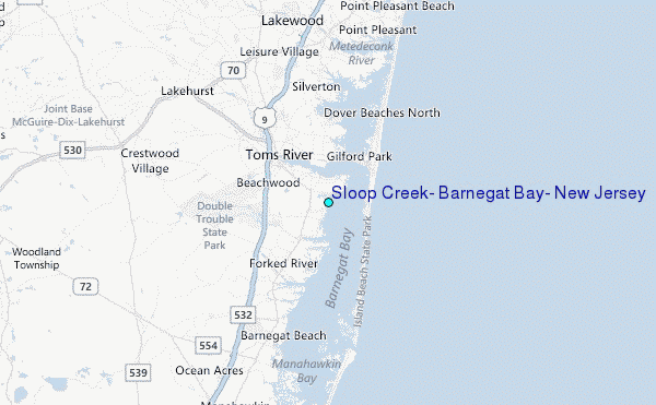
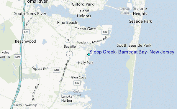
Choose Sloop Creek, Barnegat Bay, New Jersey Location Map Zoom:
| Contours: | Roads & Rivers: | Select a
tide station / surf break / city |
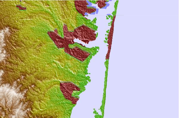
Use this relief map to navigate to tide stations, surf breaks and cities that are in the area of Sloop Creek, Barnegat Bay, New Jersey.
Other Nearby Locations' tide tables and tide charts to Sloop Creek, Barnegat Bay, New Jersey:
click location name for more details
 Surf breaks close to Sloop Creek, Barnegat Bay, New Jersey:
|
||
|---|---|---|
| Closest surf break | Seaside Park | 3 mi |
| Second closest surf break | Meters | 4 mi |
| Third closest surf break | Seaside Heights/Casino Pier | 4 mi |
| Fourth closest surf break | Tices Sholls | 5 mi |
| Fifth closest surf break | Island Beach State Park | 6 mi |


 Nearest
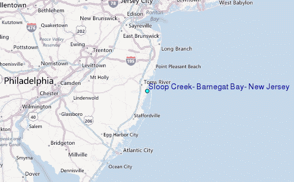