
| Distance / Altitude | Location | Report Date / Time | Live Weather | Wind | Gusts | Temp. | Visibility | Cloud |
|---|---|---|---|---|---|---|---|---|
| 4 km ENE / 240 m | Stuart/Witham Field Airport (Florida) | 2026-04-20 06:40 local (2026/04/20 10:40 GMT) | Dry and cloudy | light winds from the NNW (9 km/h at 340) | 24°C | 16 | broken broken overcast | |
| 35 km S / 7 m | West Palm Beach (FL) (Florida) | 2026-04-20 06:35 local (2026/04/20 10:35 GMT) | Dry and partly cloudy | light winds from the WNW (6 km/h at 300) | 22°C | 13 | few broken | |
| 39 km NW / 218 m | Fort Pierce Airport (Florida) | 2026-04-20 05:53 local (2026/04/20 09:53 GMT) | Dry and cloudy | light winds from the N (6 km/h at 1) | 23°C | 16 | broken broken overcast | |
| 43 km N / 3 m | Fort Pierce- FL (Marine) | 2026-04-20 07:26 local (2026/04/20 11:26 GMT) | - (- km/h at -) | — | - | |||
| 48 km N / 3 m | BUOY-41068 (Marine) | 2026-04-20 07:08 local (2026/04/20 11:08 GMT) | fresh winds from the ENE (29 km/h at 60) | 24°C | - | |||
| 56 km NW / 218 m | Vero Beach Airport (Florida) | 2026-04-20 06:21 local (2026/04/20 10:21 GMT) | Dry and partly cloudy | light winds from the NNE (15 km/h at 20) | 23°C | 16 | broken broken | |
| 56 km SSE / 218 m | West Palm Beach Airport (Florida) | 2026-04-20 05:53 local (2026/04/20 09:53 GMT) | Dry and cloudy | light winds from the SE (6 km/h at 130) | 24°C | 16 | scattered overcast | |
| 60 km WSW / 215 m | Okeechobee County Airport (FL) (United States) | 2026-04-20 06:35 local (2026/04/20 10:35 GMT) | Dry and cloudy | light winds from the NNE (15 km/h at 20) | 22°C | 16 | scattered broken overcast | |
| 64 km SSE / 0 m | thunderstorm affecting Lake Worth (United States) | 2026-04-20 05:18 local (2026/04/20 09:18 GMT) | Thunderstorm | (- km/h at -) | — | |||
| 65 km SSE / 3 m | BUOY-LKWF1 (Marine) | 2026-04-20 07:18 local (2026/04/20 11:18 GMT) | moderate winds from the S (21 km/h at 170) | — | - |
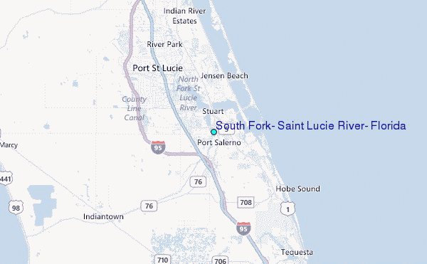
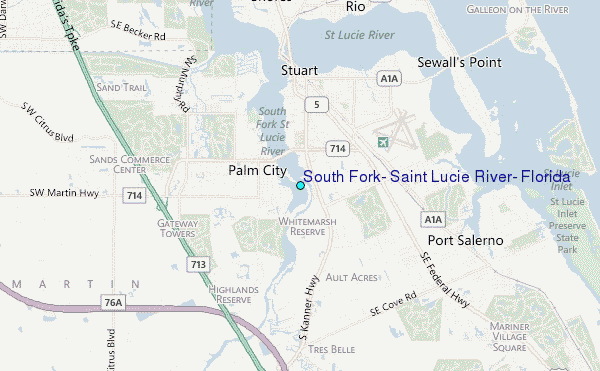
Choose South Fork, Saint Lucie River, Florida Location Map Zoom:
| Contours: | Roads & Rivers: | Select a
tide station / surf break / city |
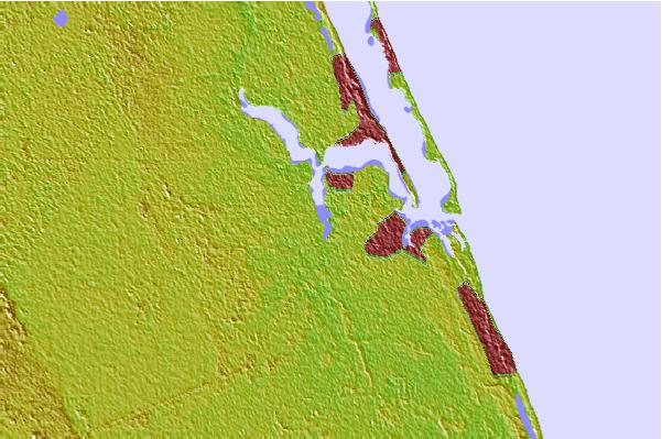

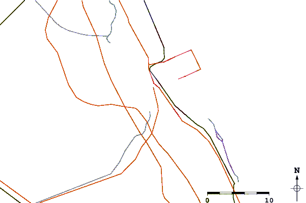
Use this relief map to navigate to tide stations, surf breaks and cities that are in the area of South Fork, Saint Lucie River, Florida.
Other Nearby Locations' tide tables and tide charts to South Fork, Saint Lucie River, Florida:
click location name for more details
 Surf breaks close to South Fork, Saint Lucie River, Florida:
|
||
|---|---|---|
| Closest surf break | Stuart Public Beach | 6 mi |
| Second closest surf break | Stuart Rocks | 6 mi |
| Third closest surf break | Jensen Beach | 7 mi |
| Fourth closest surf break | Hobe Sound/The Refuge | 8 mi |
| Fifth closest surf break | Stumps | 8 mi |


 Nearest
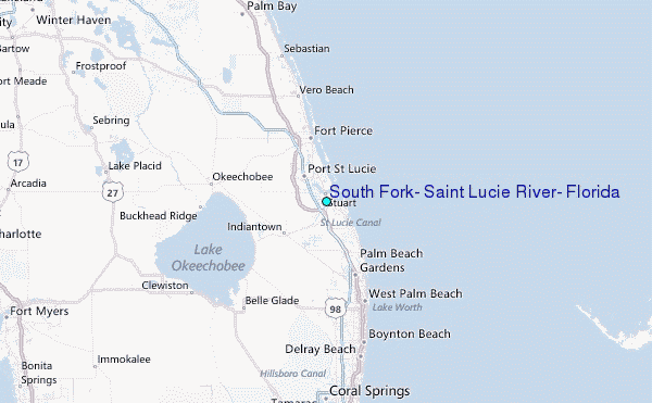