
| Distance / Altitude | Location | Report Date / Time | Live Weather | Wind | Gusts | Temp. | Visibility | Cloud |
|---|---|---|---|---|---|---|---|---|
| 18 km SSE / 2 m | Juanda Airport (Indonesia) | 2026-06-04 20:30 local (2026/06/04 13:30 GMT) | - | light winds from the ESE (13 km/h at 120) | 28°C | 8.0 | few | |
| 256 km WSW / 152 m | Bukitsari wx (Indonesia) | 2026-06-04 21:09 local (2026/06/04 14:09 GMT) | - | - (- km/h at ) | 29°C | - | - - 0 | |
| 256 km WSW / 152 m | Bukitsari wx (Indonesia) | 2026-06-04 21:11 local (2026/06/04 14:11 GMT) | - | - (- km/h at ) | 28°C | - | - - 0 | |
| 261 km WSW / 5 m | Ahmad Yani International Airport (Indonesia) | 2026-06-04 20:30 local (2026/06/04 13:30 GMT) | - | light winds from the SE (7 km/h at 130) | 30°C | 6.0 | few | |
| 296 km WSW / 1394 m | Gunungmalang wx (Indonesia) | 2026-06-04 21:11 local (2026/06/04 14:11 GMT) | dry | calm (2 km/h at 96) | 20°C | - | - - 0 | |
| 312 km WSW / 2039 m | Dieng Kulon wx (Indonesia) | 2026-06-04 21:04 local (2026/06/04 14:04 GMT) | - | wind obs. (32 kph from 92 degs) was rejected (- km/h at -) | 8°C | - | - - 0 | |
| 316 km ESE / 216 m | Bali International Airport (Indonesia) | 2026-06-04 20:30 local (2026/06/04 13:30 GMT) | - | moderate winds from the ESE (20 km/h at 120) | 28°C | 10.0 | few | |
| 383 km WSW / 101 m | Pamijen Lor wx (Indonesia) | 2026-06-04 21:03 local (2026/06/04 14:03 GMT) | - | - (- km/h at ) | 29°C | - | - - 0 | |
| 426 km ESE / 97 m | Bandara Airport (Indonesia) | 2026-06-04 20:30 local (2026/06/04 13:30 GMT) | - | calm (0 km/h at 0) | 26°C | 7.0 | few | |
| 474 km NNE / 20 m | Syamsudin Noor International Airport (Indonesia) | 2026-06-04 20:30 local (2026/06/04 13:30 GMT) | - | calm (4 km/h at 60) | 27°C | 10.0 | few |
| Contours: | Roads & Rivers: | Select a
tide station / surf break / city |
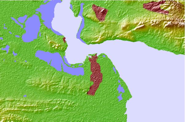
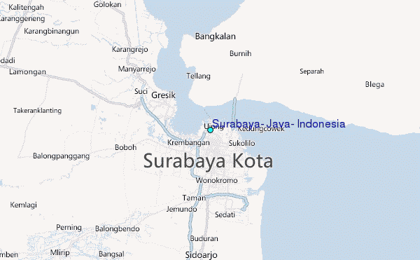
Use this relief map to navigate to tide stations, surf breaks and cities that are in the area of Surabaya, Java, Indonesia.
Other Nearby Locations' tide tables and tide charts to Surabaya, Java, Indonesia:
click location name for more details
 Surf breaks close to Surabaya, Java, Indonesia:
|
||
|---|---|---|
| Closest surf break | Grajagan Bay/G-Land | 152 mi |
| Second closest surf break | Tanjung Kucur | 155 mi |
| Third closest surf break | Medewi | 165 mi |
| Fourth closest surf break | Balian | 177 mi |
| Fifth closest surf break | Pererenan | 192 mi |


 Nearest
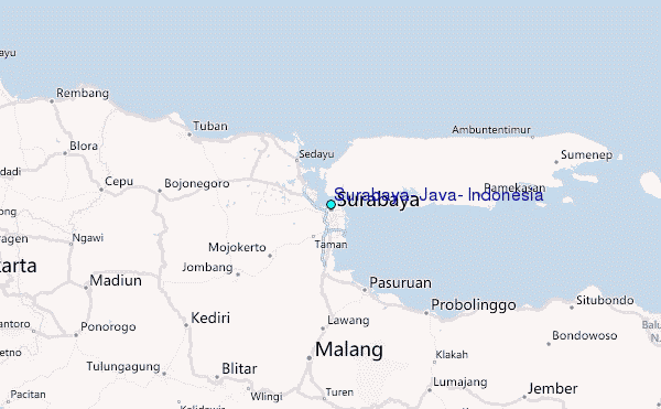