
| Distance / Altitude | Location | Report Date / Time | Live Weather | Wind | Gusts | Temp. | Visibility | Cloud |
|---|---|---|---|---|---|---|---|---|
| 31 km SW / 4 m | Samutsongkram (Thailand) | 2026-03-03 08:00 local (2026/03/03 01:00 GMT) | no report | wind obs. (17 kph from 170 degs) was rejected (- km/h at -) | 32°C | - | - | |
| 36 km ENE / 6 m | Bangkok (Thailand) | 2026-03-03 07:00 local (2026/03/03 00:00 GMT) | - | calm (4 km/h at 200) | — | 10 | - scattered - | |
| 37 km NE / 4 m | Bangkok Metropolis (Thailand) | 2026-03-03 08:00 local (2026/03/03 01:00 GMT) | no report | calm (4 km/h at 210) | 34°C | - | - | |
| 38 km ENE / 3 m | Bangna Agromet (Thailand) | 2026-03-03 08:00 local (2026/03/03 01:00 GMT) | - | wind obs. (6 kph from 230 degs) was rejected (- km/h at -) | — | - | - | |
| 38 km ESE / 89 m | Bangkok Pilot (Thailand) | 2026-03-03 08:00 local (2026/03/03 01:00 GMT) | no report | light winds from the S (19 km/h at 180) | 31°C | 10 | - scattered - | |
| 40 km NNE / 2 m | Ban Bang Phai wx (Thailand) | 2026-03-03 08:14 local (2026/03/03 01:14 GMT) | - | calm (0 km/h at 0) | 36°C | - | - - 0 | |
| 47 km NNE / 2 m | Muban Bua Thong Thani wx (Thailand) | 2026-03-03 08:48 local (2026/03/03 01:48 GMT) | - | calm (0 km/h at 0) | — | - | - - 0 | |
| 52 km E / 4 m | Samutprakan Agromet (Thailand) | 2026-03-03 08:00 local (2026/03/03 01:00 GMT) | no report | light winds from the SSW (19 km/h at 200) | 33°C | - | - | |
| 53 km WSW / 9 m | Ratcha Buri Agromet (Thailand) | 2026-03-03 07:00 local (2026/03/03 00:00 GMT) | no report | light winds from the W (15 km/h at 280) | 34°C | - | - | |
| 53 km NE / 218 m | Bangkok/Don Mueang International Airport (Thailand) | 2026-03-03 07:30 local (2026/03/03 00:30 GMT) | - | light winds from the W (11 km/h at 260) | 28°C | 10.0 | few |
| Contours: | Roads & Rivers: | Select a
tide station / surf break / city |

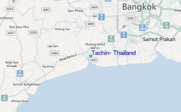
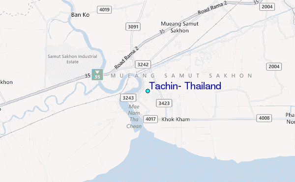
Use this relief map to navigate to tide stations, surf breaks and cities that are in the area of Tachin, Thailand.
Other Nearby Locations' tide tables and tide charts to Tachin, Thailand:
click location name for more details
 Surf breaks close to Tachin, Thailand:
|
||
|---|---|---|
| Closest surf break | Rayong Mae Ramphung Beach | 100 mi |
| Second closest surf break | Ko Samet - Sai Kaew | 104 mi |
| Third closest surf break | Hinsuay Namsay | 106 mi |
| Fourth closest surf break | Mae Phim Beach (Rayong) | 109 mi |
| Fifth closest surf break | Aho Kahi Harbor Entrance | 111 mi |


 Nearest
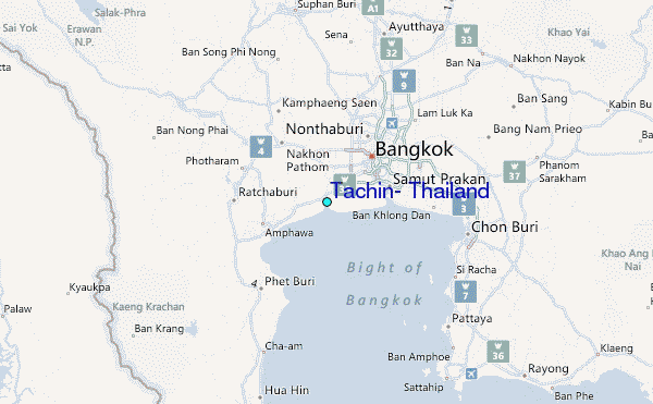