
| Distance / Altitude | Location | Report Date / Time | Live Weather | Wind | Gusts | Temp. | Visibility | Cloud |
|---|---|---|---|---|---|---|---|---|
| 44 km SSW / 50 m | Blenheim (New Zealand) | 2026-04-09 03:20 local (2026/04/08 15:20 GMT) | dry | calm (0 km/h at 244) | 10°C | - | - - 0 | |
| 49 km E / 116 m | Wellington (New Zealand) | 2026-04-09 03:02 local (2026/04/08 15:02 GMT) | dry | calm (3 km/h at 267) | 16°C | - | - - 0 | |
| 52 km E / 201 m | Wellington International Airport (New Zealand) | 2026-04-09 04:00 local (2026/04/08 16:00 GMT) | Clear skies | moderate winds from the N (22 km/h at 350) | 18°C | 20 km | - no observation - | |
| 54 km E / 51 m | Miramar wx (New Zealand) | 2026-04-09 04:10 local (2026/04/08 16:10 GMT) | dry | moderate winds from the NNW (21 km/h at 336) | 15°C | - | - - 0 | |
| 55 km S / 6 m | CapeCampbellAws (New Zealand) | 2026-04-09 04:00 local (2026/04/08 16:00 GMT) | - | strong winds from the NNW (39 km/h at 330) | 15°C | - | - no observation - | |
| 60 km ENE / 20 m | Paremata (New Zealand) | 2026-04-09 03:24 local (2026/04/08 15:24 GMT) | dry | moderate winds from the N (24 km/h at 5) | 18°C | - | - - 0 | |
| 61 km ESE / 150 m | Baring Head (New Zealand) | 2026-04-09 04:00 local (2026/04/08 16:00 GMT) | - | moderate winds from the NNE (24 km/h at 32) | 15°C | - | - - 0 | |
| 65 km NW / -152 m | Stephens Island Automatic Weather Station (New Zealand) | 2026-04-09 04:00 local (2026/04/08 16:00 GMT) | - | fresh winds from the W (37 km/h at 270) | 16°C | - | - no observation - | |
| 66 km ESE / 300 m | Heights Road (New Zealand) | 2026-04-09 04:00 local (2026/04/08 16:00 GMT) | - | strong winds from the ENE (46 km/h at 69) | 17°C | - | - - 0 | |
| 68 km ENE / 267 m | Paekakariki (New Zealand) | 2026-04-09 04:00 local (2026/04/08 16:00 GMT) | - | near gales from the NNW (59 km/h at 340) | 15°C | - | - - 0 |
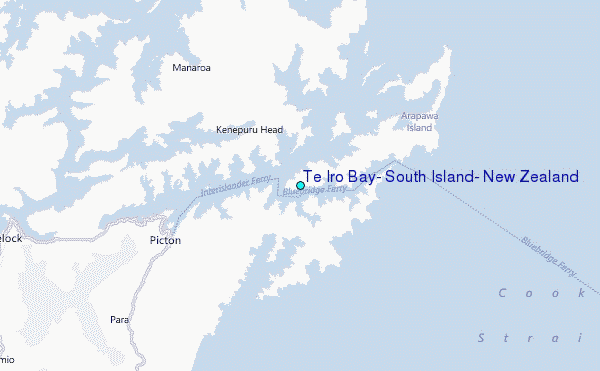
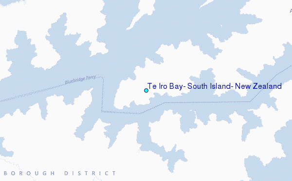
Choose Te Iro Bay, South Island, New Zealand Location Map Zoom:
| Contours: | Roads & Rivers: | Select a
tide station / surf break / city |
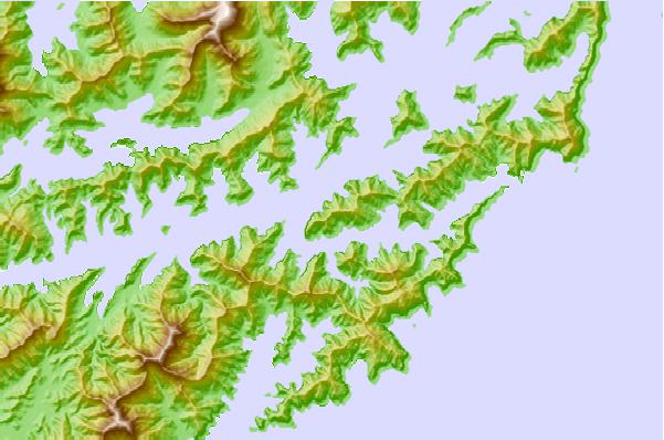
Use this relief map to navigate to tide stations, surf breaks and cities that are in the area of Te Iro Bay, South Island, New Zealand.
Other Nearby Locations' tide tables and tide charts to Te Iro Bay, South Island, New Zealand:
click location name for more details
 Surf breaks close to Te Iro Bay, South Island, New Zealand:
|
||
|---|---|---|
| Closest surf break | Robin Hood Bay | 12 mi |
| Second closest surf break | Whites Bay | 13 mi |
| Third closest surf break | Te Ikaamaru Bay | 24 mi |
| Fourth closest surf break | Makara | 25 mi |
| Fifth closest surf break | The Island (Island Bay) | 32 mi |


 Nearest
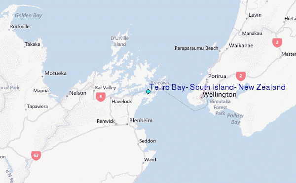