
| Distance / Altitude | Location | Report Date / Time | Live Weather | Wind | Gusts | Temp. | Visibility | Cloud |
|---|---|---|---|---|---|---|---|---|
| 3 km SSW / 3 m | SHIP9165 (Marine) | 2026-04-19 18:00 local (2026/04/19 08:00 GMT) | - (- km/h at -) | 29°C | - | |||
| 8 km E / 5 m | Horn Island Automatic Weather Station (Australia) | 2026-04-19 20:00 local (2026/04/19 10:00 GMT) | no report | light winds from the SSE (19 km/h at 150) | 28°C | - | - no observation - | |
| 9 km E / 13 m | Horn Island Airport (Australia) | 2026-04-19 19:30 local (2026/04/19 09:30 GMT) | - | light winds from the SSE (17 km/h at 150) | 28°C | 10.0 | few | |
| 183 km WNW / 0 m | lightning 130km SW of Morehead (Papua New Guinea) | 2026-04-19 20:50 local (2026/04/19 10:50 GMT) | Thunderstorm | (- km/h at -) | — | |||
| 198 km SW / 0 m | lightning 222km NW of Weipa (Australia) | 2026-04-19 20:50 local (2026/04/19 10:50 GMT) | Thunderstorm | (- km/h at -) | — | |||
| 3 km SSW / 15 m | SHIP4360 (Marine) | 2026-04-19 19:00 local (2026/04/19 09:00 GMT) | - (- km/h at -) | — | - km | |||
| 3 km SSW / 15 m | SHIP6447 (Marine) | 2026-04-19 19:00 local (2026/04/19 09:00 GMT) | - (- km/h at -) | — | - km | |||
| 3 km SSW / 15 m | SHIP3429 (Marine) | 2026-04-19 18:00 local (2026/04/19 08:00 GMT) | - (- km/h at -) | 29°C | - km | |||
| 3 km SSW / 15 m | SHIP2479 (Marine) | 2026-04-19 19:00 local (2026/04/19 09:00 GMT) | - (- km/h at -) | — | - km | |||
| 3 km SSW / 3 m | SHIP4182 (Marine) | 2026-04-19 19:00 local (2026/04/19 09:00 GMT) | - (- km/h at -) | 29°C | - |
| Contours: | Roads & Rivers: | Select a
tide station / surf break / city |
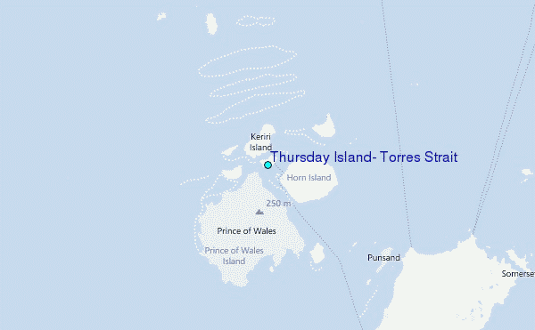
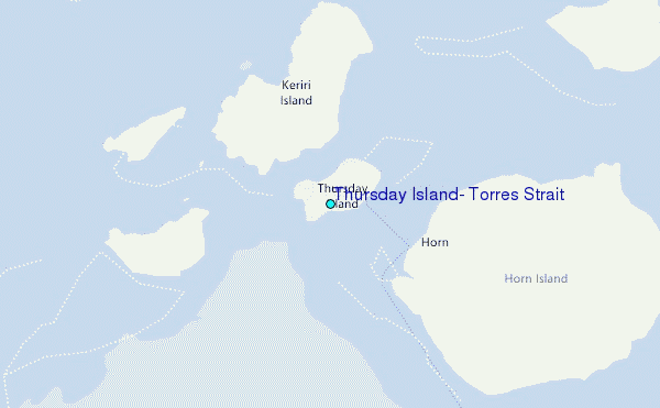
Use this relief map to navigate to tide stations, surf breaks and cities that are in the area of Thursday Island, Torres Strait.
Other Nearby Locations' tide tables and tide charts to Thursday Island, Torres Strait:
click location name for more details
 Surf breaks close to Thursday Island, Torres Strait:
|
||
|---|---|---|
| Closest surf break | Tupira Right | 478 mi |
| Second closest surf break | Forok Point | 493 mi |
| Third closest surf break | The Wharf (Mission Point) | 495 mi |
| Fourth closest surf break | Wewak Point | 496 mi |
| Fifth closest surf break | Moem Point | 497 mi |


 Nearest
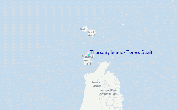