
| Distance / Altitude | Location | Report Date / Time | Live Weather | Wind | Gusts | Temp. | Visibility | Cloud |
|---|---|---|---|---|---|---|---|---|
| 64 km S / 83 m | Natal Airport (Brazil) | 2025-12-23 21:00 local (2025/12/24 00:00 GMT) | Dry and partly cloudy | light winds from the SE.(Wind varies from 080 to 170 degs) (11 km/h at 130) | 26°C | 10.0 | scattered | |
| 83 km SSE / 216 m | Natal/Augusto Severo Airport (Brazil) | 2025-12-23 20:00 local (2025/12/23 23:00 GMT) | - | moderate winds from the SE (24 km/h at 140) | 27°C | 10.0 | few | |
| 91 km ESE / 15 m | ASCATB325E6S (Marine) | 2025-12-23 20:37 local (2025/12/23 23:37 GMT) | fresh winds from the SE (33 km/h at 135) | — | - km | |||
| 105 km NE / 15 m | ASCATB325E5S (Marine) | 2025-12-23 20:37 local (2025/12/23 23:37 GMT) | fresh winds from the SE (32 km/h at 132) | — | - km | |||
| 139 km WSW / 6 m | Macau (81836 -0) (Brazil) | 2025-12-23 21:00 local (2025/12/24 00:00 GMT) | no report | wind obs. (11 kph from 160 degs) was rejected (- km/h at -) | 26°C | - | - | |
| 140 km ESE / 15 m | ASCATB326E6S (Marine) | 2025-12-23 20:37 local (2025/12/23 23:37 GMT) | fresh winds from the SE (30 km/h at 130) | — | - km | |||
| 144 km ENE / 15 m | ASCATB326E5S (Marine) | 2025-12-23 20:37 local (2025/12/23 23:37 GMT) | fresh winds from the SE (30 km/h at 129) | — | - km | |||
| 160 km SSE / 138 m | Camaratuba (Brazil) | 2025-12-23 21:00 local (2025/12/24 00:00 GMT) | no report | calm (0 km/h at 200) | 23°C | - | - | |
| 181 km SE / 15 m | ASCATB326E7S (Marine) | 2025-12-23 20:36 local (2025/12/23 23:36 GMT) | fresh winds from the SE (30 km/h at 138) | — | - km | |||
| 188 km N / 15 m | ASCATB324E4S (Marine) | 2025-12-23 20:37 local (2025/12/23 23:37 GMT) | fresh winds from the ESE (31 km/h at 118) | — | - km |
| Contours: | Roads & Rivers: | Select a
tide station / surf break / city |

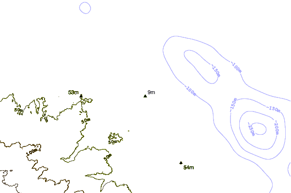
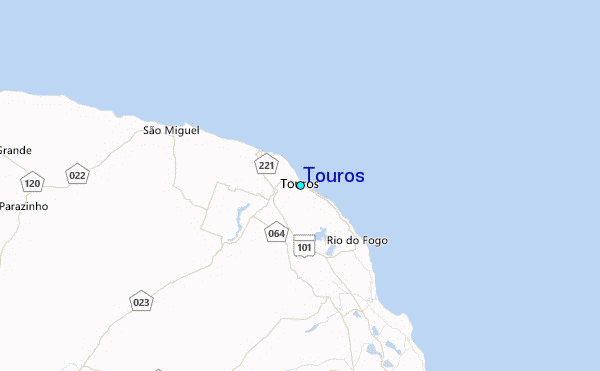
Use this relief map to navigate to tide stations, surf breaks and cities that are in the area of Touros.
Other Nearby Locations' tide tables and tide charts to Touros:
click location name for more details
 Surf breaks close to Touros:
|
||
|---|---|---|
| Closest surf break | Touros Area | 1 mi |
| Second closest surf break | Urca da Conceicao | 25 mi |
| Third closest surf break | Cocoa das Lavadeiras | 29 mi |
| Fourth closest surf break | Genipabu | 39 mi |
| Fifth closest surf break | Praia dos Artistas | 44 mi |


 Nearest