
| Distance / Altitude | Location | Report Date / Time | Live Weather | Wind | Gusts | Temp. | Visibility | Cloud |
|---|---|---|---|---|---|---|---|---|
| 15 km S / 0 m | lightning 102km N of Kununurra (Australia) | 2026-02-11 06:20 local (2026/02/10 20:50 GMT) | Thunderstorm | (- km/h at -) | — | |||
| 72 km NNE / 29 m | Port Keats Airport (Australia) | 2026-02-11 07:30 local (2026/02/10 22:00 GMT) | no report | calm (2 km/h at 200) | 25°C | - | - no observation - | |
| 119 km S / 216 m | Kununurra Airport (Australia) | 2026-02-11 07:00 local (2026/02/10 21:30 GMT) | Moderate rain | light winds from the ENE (7 km/h at 70) | 27°C | 10.0 | overcast broken broken | |
| 119 km S / 44 m | KununurraAero (Australia) | 2026-02-11 07:30 local (2026/02/10 22:00 GMT) | Continuous light rain | light winds from the N (6 km/h at 360) | 27°C | - | - mostly cloudy - | |
| 138 km SW / 4 m | Wyndham Aerodrome (Australia) | 2026-02-11 07:30 local (2026/02/10 22:00 GMT) | no report | light winds from the N (7 km/h at 360) | 25°C | - | - no observation - | |
| 159 km ESE / 110 m | Bradshaw - Angallari Valley (Defence) (Australia) | 2026-02-11 07:30 local (2026/02/10 22:00 GMT) | no report | wind obs. (6 kph from 240 degs) was rejected (- km/h at -) | 25°C | - | - no observation - | |
| 170 km E / 76 m | Bradshaw (Australia) | 2026-02-11 06:30 local (2026/02/10 21:00 GMT) | no report | - (- km/h at -) | 26°C | - | - | |
| 217 km S / 165 m | Argyle Aerodrome Airport (Australia) | 2026-02-11 06:30 local (2026/02/10 21:00 GMT) | no report | - (- km/h at -) | 27°C | - | - | |
| 217 km S / 165 m | Argyle Aerodrome (Australia) | 2026-02-11 06:30 local (2026/02/10 21:00 GMT) | no report | - (- km/h at -) | 27°C | - | - - - | |
| 238 km ENE / 44 m | Douglas River (Australia) | 2026-02-11 07:30 local (2026/02/10 22:00 GMT) | no report | calm (4 km/h at 180) | 25°C | - | - no observation - |
| Contours: | Roads & Rivers: | Select a
tide station / surf break / city |

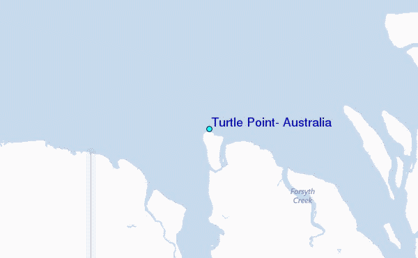
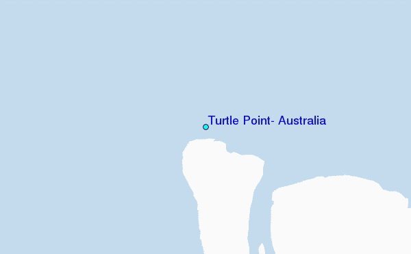
Use this relief map to navigate to tide stations, surf breaks and cities that are in the area of Turtle Point, Australia.
Other Nearby Locations' tide tables and tide charts to Turtle Point, Australia:
click location name for more details
 Surf breaks close to Turtle Point, Australia:
|
||
|---|---|---|
| Closest surf break | Fannie Bay | 198 mi |
| Second closest surf break | Rapid Creek - Bar | 202 mi |
| Third closest surf break | Rapid Creek - Reef | 202 mi |
| Fourth closest surf break | Rapid Creek - Beach | 203 mi |
| Fifth closest surf break | Casuarina (Darwin) | 209 mi |


 Nearest
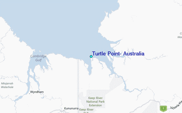