
| Distance / Altitude | Location | Report Date / Time | Live Weather | Wind | Gusts | Temp. | Visibility | Cloud |
|---|---|---|---|---|---|---|---|---|
| 57 km S / 283 m | Poca Rica New Airport (Mexico) | 2026-05-01 07:48 local (2026/05/01 13:48 GMT) | Mist - | light winds from the E (11 km/h at 90) | 26°C | 2 | broken | |
| 147 km SSW / 2214 m | Tulancingo (Mexico) | 2026-05-01 06:00 local (2026/05/01 12:00 GMT) | no report | calm (4 km/h at 140) | 16°C | 3000 | - - - | |
| 149 km SSW / 2181 m | Tulancingo (Mexico) | 2026-05-01 07:41 local (2026/05/01 13:41 GMT) | Dry and partly cloudy | wind obs. (17 kph from 80 degs) was rejected (- km/h at -) | 28°C | 11 | scattered | |
| 151 km NW / 275 m | Tampico/General Francisco Javier Mina International Airpor Airport (Mexico) | 2026-05-01 06:54 local (2026/05/01 12:54 GMT) | Dry and partly cloudy | calm (4 km/h at 40) | 26°C | 6 | scattered | |
| 174 km NW / 11 m | El Ensayo wx (Mexico) | 2026-05-01 08:19 local (2026/05/01 14:19 GMT) | dry | light winds from the E (19 km/h at 81) | 26°C | - | - - 0 | |
| 222 km S / 2253 m | San Martin Texmelucan de Labastida wx (Mexico) | 2026-05-01 07:14 local (2026/05/01 13:14 GMT) | - | - (- km/h at ) | 24°C | - | - - 0 | |
| 232 km NW / 89 m | Villafaña wx (Mexico) | 2026-05-01 06:39 local (2026/05/01 12:39 GMT) | dry | calm (5 km/h at 73) | 26°C | - | - - 0 | |
| 234 km S / 2147 m | Fuentes del Molino wx (Mexico) | 2026-05-01 07:38 local (2026/05/01 13:38 GMT) | - | calm (0 km/h at 0) | 28°C | - | - - 0 | |
| 240 km S / 2098 m | Magisterial wx (Mexico) | 2026-05-01 07:00 local (2026/05/01 13:00 GMT) | - | - (- km/h at ) | — | - | - - 0 | |
| 243 km SSE / 456 m | Veracruz Airport (Mexico) | 2026-05-01 07:40 local (2026/05/01 13:40 GMT) | - | light winds from the S (7 km/h at 190) | — | 6 |
| Contours: | Roads & Rivers: | Select a
tide station / surf break / city |
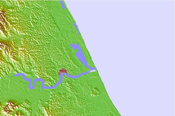
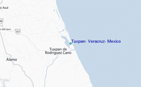
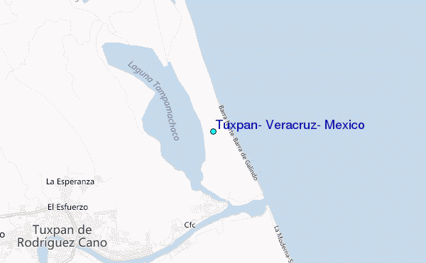
Use this relief map to navigate to tide stations, surf breaks and cities that are in the area of Tuxpan, Veracruz, Mexico.
Other Nearby Locations' tide tables and tide charts to Tuxpan, Veracruz, Mexico:
click location name for more details
 Surf breaks close to Tuxpan, Veracruz, Mexico:
|
||
|---|---|---|
| Closest surf break | Las Animas | 324 mi |
| Second closest surf break | Punta Acamama | 325 mi |
| Third closest surf break | Dorado Dos | 328 mi |
| Fourth closest surf break | Marquella | 329 mi |
| Fifth closest surf break | Pinitas | 331 mi |


 Nearest