
| Distance / Altitude | Location | Report Date / Time | Live Weather | Wind | Gusts | Temp. | Visibility | Cloud |
|---|---|---|---|---|---|---|---|---|
| 9 km ENE / 3 m | BUOY-NWPR1 (Marine) | 2025-12-25 04:48 local (2025/12/25 09:48 GMT) | light winds from the SW (11 km/h at 230) | — | - | |||
| 15 km NE / 218 m | Newport Airport (Rhode Island) | 2025-12-25 03:53 local (2025/12/25 08:53 GMT) | - | light winds from the SSW (6 km/h at 210) | -2°C | 16 | few | |
| 16 km N / 273 m | Nort Kingston/Quonset State Airport (Rhode Island) | 2025-12-25 04:35 local (2025/12/25 09:35 GMT) | Dry and partly cloudy | light winds from the SSW (11 km/h at 210) | -1°C | 16 | broken | |
| 17 km N / 3 m | BUOY-PDVR1 (Marine) | 2025-12-25 04:48 local (2025/12/25 09:48 GMT) | light winds from the SSW (13 km/h at 200) | — | - | |||
| 21 km NNE / 3 m | BUOY-PTCR1 (Marine) | 2025-12-25 04:48 local (2025/12/25 09:48 GMT) | light winds from the WSW (9 km/h at 240) | — | - | |||
| 21 km NNE / 3 m | BUOY-NAXR1 (Marine) | 2025-12-25 03:45 local (2025/12/25 08:45 GMT) | light winds from the NW (9 km/h at 310) | -1°C | - | |||
| 29 km N / 218 m | Providence/Theodore Francis Green State Airport (Rhode Island) | 2025-12-25 03:51 local (2025/12/25 08:51 GMT) | Clear | light winds from the SW (9 km/h at 220) | -2°C | 16 | ||
| 30 km NNE / 3 m | BUOY-CPTR1 (Marine) | 2025-12-25 04:48 local (2025/12/25 09:48 GMT) | moderate winds from the SSW (21 km/h at 200) | — | - | |||
| 33 km SW / 218 m | Westerly Airport (Rhode Island) | 2025-12-25 03:53 local (2025/12/25 08:53 GMT) | Dry and partly cloudy | calm (0 km/h at 0) | -2°C | 16 | broken | |
| 34 km E / 3 m | BUOY-BUZM3 (Marine) | 2025-12-25 05:00 local (2025/12/25 10:00 GMT) | moderate winds from the SW (26 km/h at 230) | — | - |
Choose Watson Pier, Boston Neck, Narragansett Bay, Rhode Island Location Map Zoom:
| Contours: | Roads & Rivers: | Select a
tide station / surf break / city |
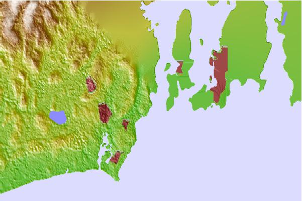
Use this relief map to navigate to tide stations, surf breaks and cities that are in the area of Watson Pier, Boston Neck, Narragansett Bay, Rhode Island.
Other Nearby Locations' tide tables and tide charts to Watson Pier, Boston Neck, Narragansett Bay, Rhode Island:
click location name for more details
 Surf breaks close to Watson Pier, Boston Neck, Narragansett Bay, Rhode Island:
|
||
|---|---|---|
| Closest surf break | Bonnet Point | 1 mi |
| Second closest surf break | Bonnet Shores Point | 2 mi |
| Third closest surf break | Narragansett Town Beach | 2 mi |
| Fourth closest surf break | North Pier (Narragansett) | 2 mi |
| Fifth closest surf break | Monahans Dock | 3 mi |


 Nearest