
| Distance / Altitude | Location | Report Date / Time | Live Weather | Wind | Gusts | Temp. | Visibility | Cloud |
|---|---|---|---|---|---|---|---|---|
| 18 km NW / 41 m | Dix Hills (New York) | 2025-12-25 18:29 local (2025/12/25 23:29 GMT) | - | wind obs. (13 kph from 276 degs) was rejected (- km/h at -) | 2°C | - | - - 0 | |
| 18 km NW / 283 m | Brookhaven Lab Airport (New York) | 2025-12-25 18:35 local (2025/12/25 23:35 GMT) | - | calm (0 km/h at 0) | — | 14 | broken - - | |
| 18 km NNE / 218 m | Islip Airport (New York) | 2025-12-25 17:56 local (2025/12/25 22:56 GMT) | - | calm (4 km/h at 345) | 4°C | 16 | few few broken | |
| 20 km W / 218 m | Farmingdale Airport (New York) | 2025-12-25 17:53 local (2025/12/25 22:53 GMT) | Clear | fresh winds from the NNW (31 km/h at 340) | 5°C | 16 | ||
| 23 km W / 22 m | Farmingdale (New York) | 2025-12-25 18:38 local (2025/12/25 23:38 GMT) | - | calm (0 km/h at 40) | — | - | - - 0 | |
| 34 km ENE / 217 m | Shirley Airport (New York) | 2025-12-25 17:56 local (2025/12/25 22:56 GMT) | Clear | fresh winds from the NNW (35 km/h at 340) | 3°C | 16 | ||
| 40 km S / - m | SHIP1166 (ocean) | 2025-12-25 18:00 local (2025/12/25 23:00 GMT) | - | strong winds from the NW (47 km/h at 320) | 7°C | - | no observation | |
| 40 km S / - m | SHIP224 (ocean) | 2025-12-25 18:00 local (2025/12/25 23:00 GMT) | - | strong winds from the NW (47 km/h at 320) | 7°C | - | no observation | |
| 40 km S / - m | SHIP395 (ocean) | 2025-12-25 18:00 local (2025/12/25 23:00 GMT) | - | strong winds from the NW (47 km/h at 320) | 7°C | - | no observation | |
| 40 km S / - m | SHIP579 (ocean) | 2025-12-25 18:00 local (2025/12/25 23:00 GMT) | - | strong winds from the NNW (47 km/h at 330) | 7°C | - | no observation |
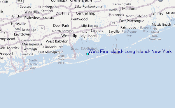
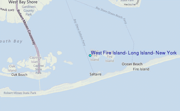
Choose West Fire Island, Long Island, New York Location Map Zoom:
| Contours: | Roads & Rivers: | Select a
tide station / surf break / city |
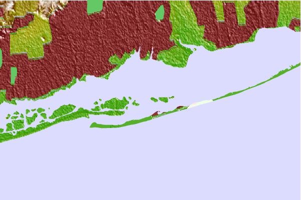
Use this relief map to navigate to tide stations, surf breaks and cities that are in the area of West Fire Island, Long Island, New York.
Other Nearby Locations' tide tables and tide charts to West Fire Island, Long Island, New York:
click location name for more details
 Surf breaks close to West Fire Island, Long Island, New York:
|
||
|---|---|---|
| Closest surf break | Robert Moses State Park | 4 mi |
| Second closest surf break | Point o Woods | 4 mi |
| Third closest surf break | Coastguards | 6 mi |
| Fourth closest surf break | Democrat Point Robert Moses | 6 mi |
| Fifth closest surf break | Gilgo | 11 mi |


 Nearest
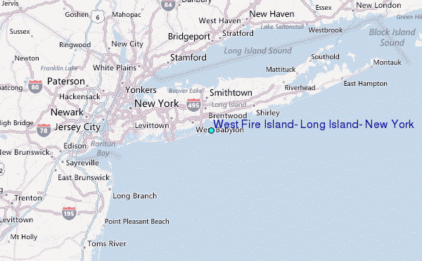