
| Distance / Altitude | Location | Report Date / Time | Live Weather | Wind | Gusts | Temp. | Visibility | Cloud |
|---|---|---|---|---|---|---|---|---|
| 41 km E / 3 m | BUOY-PTFL1 (Marine) | 2026-05-18 04:48 local (2026/05/18 09:48 GMT) | - (- km/h at -) | — | - | |||
| 53 km NE / 216 m | Galliano- South Lafourche Airport (LA) (United States) | 2026-05-18 04:35 local (2026/05/18 09:35 GMT) | Dry and partly cloudy | light winds from the SE (7 km/h at 140) | 25°C | 16 | scattered | |
| 67 km ENE / 3 m | BUOY-GISL1 (Marine) | 2026-05-18 04:48 local (2026/05/18 09:48 GMT) | light winds from the ESE (15 km/h at 120) | — | - | |||
| 78 km SSW / 31 m | Ship Shoal178 (Louisiana) | 2026-05-18 04:35 local (2026/05/18 09:35 GMT) | - | moderate winds from the SE (26 km/h at 130) | 26°C | 14 | few few | |
| 79 km SSW / 3 m | BUOY-KSPR (Marine) | 2026-05-18 04:55 local (2026/05/18 09:55 GMT) | moderate winds from the ESE (26 km/h at 120) | 26°C | 16.1 | |||
| 81 km NNE / 3 m | BUOY-BYGL1 (Marine) | 2026-05-18 04:48 local (2026/05/18 09:48 GMT) | - (- km/h at -) | — | - | |||
| 81 km W / 3 m | BUOY-EINL1 (Marine) | 2026-05-18 04:48 local (2026/05/18 09:48 GMT) | moderate winds from the ESE (21 km/h at 120) | — | - | |||
| 81 km W / 3 m | BUOY-AMRL1 (Marine) | 2026-05-18 04:48 local (2026/05/18 09:48 GMT) | calm (4 km/h at 120) | — | - | |||
| 83 km S / 25 m | Ship Shoal 241 Airport (Louisiana) (Louisiana) | 2026-05-18 04:35 local (2026/05/18 09:35 GMT) | Dry and cloudy | moderate winds from the ESE (24 km/h at 120) | 26°C | 11 | overcast | |
| 89 km WNW / 3 m | BUOY-TESL1 (Marine) | 2026-05-18 04:48 local (2026/05/18 09:48 GMT) | light winds from the ESE (8 km/h at 120) | — | - |
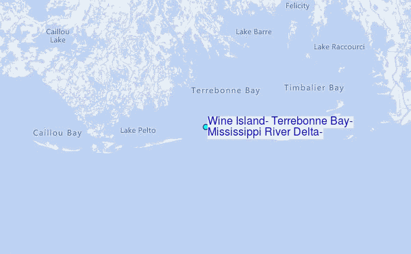
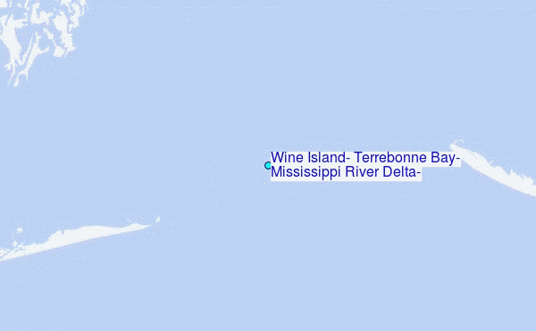
Choose Wine Island, Terrebonne Bay, Mississippi River Delta, Louisiana Location Map Zoom:
| Contours: | Roads & Rivers: | Select a
tide station / surf break / city |

Use this relief map to navigate to tide stations, surf breaks and cities that are in the area of Wine Island, Terrebonne Bay, Mississippi River Delta, Louisiana.
Other Nearby Locations' tide tables and tide charts to Wine Island, Terrebonne Bay, Mississippi River Delta, Louisiana:
click location name for more details
 Surf breaks close to Wine Island, Terrebonne Bay, Mississippi River Delta, Louisiana:
|
||
|---|---|---|
| Closest surf break | Chandeleur Islands | 119 mi |
| Second closest surf break | Dauphin Island Pier | 173 mi |
| Third closest surf break | Holly Beach | 178 mi |
| Fourth closest surf break | West Pass | 191 mi |
| Fifth closest surf break | Terry s Cove | 200 mi |


 Nearest
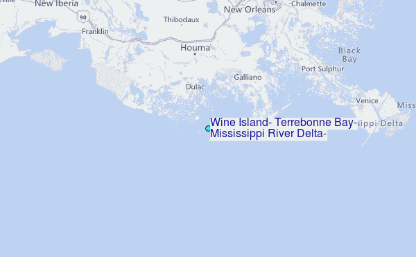