
| Distance / Altitude | Location | Report Date / Time | Live Weather | Wind | Gusts | Temp. | Visibility | Cloud |
|---|---|---|---|---|---|---|---|---|
| 10 km NE / 218 m | Fort Belvoir/Davison Airport (Virginia) | 2026-04-05 04:55 local (2026/04/05 08:55 GMT) | - | light winds from the S (15 km/h at 180) | 22°C | 16 | few | |
| 18 km S / 219 m | Quantico Marine Corps Air Facility Airport (Virginia) | 2026-04-05 04:56 local (2026/04/05 08:56 GMT) | Clear | moderate winds from the SSW (20 km/h at 200) | 22°C | 14 | ||
| 24 km W / 206 m | Manassas Municipal Airport (Virginia) | 2026-04-05 04:56 local (2026/04/05 08:56 GMT) | Clear | moderate winds from the SSW (20 km/h at 200) | 22°C | 16 | ||
| 25 km NE / 11 m | Alexandria (Virginia) | 2026-04-05 05:40 local (2026/04/05 09:40 GMT) | dry | calm (0 km/h at 0) | 8°C | - | - - 0 | |
| 28 km NE / 218 m | Washington/National Airport (Washington D.c.) | 2026-04-05 04:52 local (2026/04/05 08:52 GMT) | Dry and partly cloudy | moderate winds from the SSW (28 km/h at 200) | 22°C | 16 | broken | |
| 31 km NE / 3 m | BUOY-WASD2 (Marine) | 2026-04-05 05:30 local (2026/04/05 09:30 GMT) | light winds from the SSW (17 km/h at 210) | 22°C | - | |||
| 34 km S / 217 m | Stafford Regional Airport (Virginia) | 2026-04-05 05:35 local (2026/04/05 09:35 GMT) | Clear | light winds from the SSW (15 km/h at 200) | 22°C | 16 | ||
| 34 km WSW / 108 m | Greenville wx (United States) | 2026-04-05 06:08 local (2026/04/05 10:08 GMT) | dry | calm (3 km/h at 129) | 19°C | - | - - 0 | |
| 35 km NW / 218 m | Wash DC/Dulles Airport (Virginia) | 2026-04-05 04:52 local (2026/04/05 08:52 GMT) | Dry and partly cloudy | moderate winds from the SSW (28 km/h at 200) | 22°C | 16 | broken | |
| 38 km ENE / 217 m | Andrews Air Force Base Airport (Maryland) | 2026-04-05 04:55 local (2026/04/05 08:55 GMT) | Dry and partly cloudy | fresh winds from the SSW (33 km/h at 200) | 22°C | 16 | scattered broken |
| Contours: | Roads & Rivers: | Select a
tide station / surf break / city |
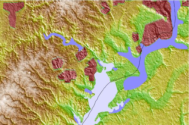
Use this relief map to navigate to tide stations, surf breaks and cities that are in the area of Woodbridge.
Other Nearby Locations' tide tables and tide charts to Woodbridge:
click location name for more details
 Surf breaks close to Woodbridge:
|
||
|---|---|---|
| Closest surf break | Out Front | 116 mi |
| Second closest surf break | Chincoteague | 117 mi |
| Third closest surf break | Naval Jetties | 117 mi |
| Fourth closest surf break | The Cove Delaware | 117 mi |
| Fifth closest surf break | Dewey Beach | 117 mi |


 Nearest