
| Distance / Altitude | Location | Report Date / Time | Live Weather | Wind | Gusts | Temp. | Visibility | Cloud |
|---|---|---|---|---|---|---|---|---|
| 106 km SSW / 15 m | SHIP4890 (Marine) | 2025-12-25 14:00 local (2025/12/25 07:00 GMT) | - (- km/h at -) | — | - km | |||
| 126 km SW / 2 m | Juanda Airport (Indonesia) | 2025-12-25 16:00 local (2025/12/25 09:00 GMT) | Light to moderate thunderstorm | wind obs. (7 kph from 230 degs) was rejected (- km/h at -) | 27°C | 5.0 km | scattered overcast - | |
| 128 km WSW / 3 m | SurabayaPerakI (Indonesia) | 2025-12-25 16:00 local (2025/12/25 09:00 GMT) | Intermittent light rain | wind obs. (6 kph from 150 degs) was rejected (- km/h at -) | 30°C | 28 km | - overcast - | |
| 239 km SE / 216 m | Bali International Airport (Indonesia) | 2025-12-25 15:30 local (2025/12/25 08:30 GMT) | - | moderate winds from the W (24 km/h at 260) | 31°C | 10.0 | few | |
| 241 km SE / 1 m | DenpasarNgurahRai (Indonesia) | 2025-12-25 16:00 local (2025/12/25 09:00 GMT) | - | moderate winds from the W (24 km/h at 260) | 31°C | 30 km | scattered | |
| 105 km SSW / 15 m | SHIP8839 (Marine) | 2025-12-25 14:00 local (2025/12/25 07:00 GMT) | - (- km/h at -) | — | - km | |||
| 105 km SSW / 15 m | SHIP8187 (Marine) | 2025-12-25 15:00 local (2025/12/25 08:00 GMT) | - (- km/h at -) | — | - km | |||
| 105 km SSW / 3 m | SHIP8363 (Marine) | 2025-12-25 14:00 local (2025/12/25 07:00 GMT) | - (- km/h at -) | 31°C | - | |||
| 105 km SSW / 15 m | SHIP4296 (Marine) | 2025-12-25 14:00 local (2025/12/25 07:00 GMT) | - (- km/h at -) | — | - km | |||
| 105 km SSW / 15 m | SHIP4428 (Marine) | 2025-12-25 15:00 local (2025/12/25 08:00 GMT) | - (- km/h at -) | — | - km |
| Contours: | Roads & Rivers: | Select a
tide station / surf break / city |
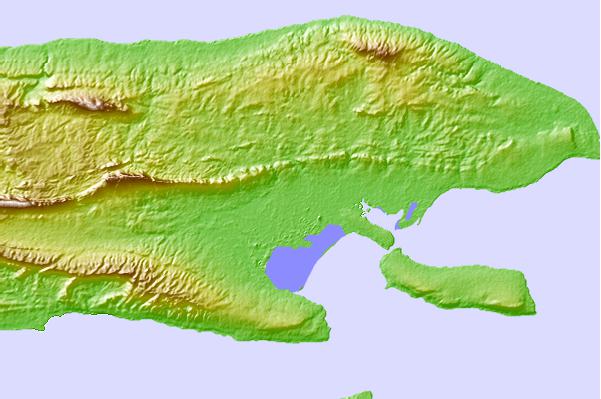
Use this relief map to navigate to tide stations, surf breaks and cities that are in the area of Sumenep.
Other Nearby Locations' tide tables and tide charts to Sumenep:
click location name for more details
 Surf breaks close to Sumenep:
|
||
|---|---|---|
| Closest surf break | Medewi | 117 mi |
| Second closest surf break | Tanjung Kucur | 119 mi |
| Third closest surf break | Grajagan Bay/G-Land | 122 mi |
| Fourth closest surf break | Balian | 127 mi |
| Fifth closest surf break | Pererenan | 143 mi |


 Nearest