
| Distance / Altitude | Location | Report Date / Time | Live Weather | Wind | Gusts | Temp. | Visibility | Cloud |
|---|---|---|---|---|---|---|---|---|
| 11 km ESE / 215 m | Kota Bharu-sultan P (Malaysia) | 2025-12-25 17:00 local (2025/12/25 09:00 GMT) | Light rain | light winds from the NE.(Wind varies from 010 to 080 degs) (13 km/h at 50) | 27°C | 10.0 | few few scattered | |
| 13 km ESE / 5 m | KotaBharu (Malaysia) | 2025-12-25 18:00 local (2025/12/25 10:00 GMT) | no report | wind obs. (13 kph from 300 degs) was rejected (- km/h at -) | 31°C | 16 | - mostly cloudy - | |
| 31 km SSE / 69 m | Padang Teratak Batang wx (Malaysia) | 2025-12-25 18:14 local (2025/12/25 10:14 GMT) | - | - (- km/h at ) | 31°C | - | - - 0 | |
| 46 km W / 91 m | Narathiwat (Thailand) | 2025-12-25 18:00 local (2025/12/25 10:00 GMT) | no report | calm (4 km/h at 250) | 32°C | 28 km | - overcast - | |
| 58 km WNW / 217 m | Narathiwat Airport (Thailand) | 2025-12-25 17:00 local (2025/12/25 09:00 GMT) | Dry and partly cloudy | light winds from the NNE (9 km/h at 20) | 26°C | 9.0 | few scattered | |
| 105 km W / 36 m | Yala Agromet (Thailand) | 2025-12-25 18:00 local (2025/12/25 10:00 GMT) | no report | wind obs. (11 kph from 260 degs) was rejected (- km/h at -) | 32°C | - | - no observation - | |
| 130 km W / 9 m | Pattani (Thailand) | 2025-12-25 18:00 local (2025/12/25 10:00 GMT) | Heavy thunderstorm | wind obs. (6 kph from 350 degs) was rejected (- km/h at -) | 25°C | 5.0 km | - overcast - | |
| 137 km SE / 216 m | Kuala Trengganu Airport (Malaysia) | 2025-12-25 17:00 local (2025/12/25 09:00 GMT) | - | light winds from the NNW.(Wind varies from 300 to 020 degs) (19 km/h at 340) | 29°C | 10.0 | few | |
| 137 km SE / 6 m | KualaTrengganu (Malaysia) | 2025-12-25 18:00 local (2025/12/25 10:00 GMT) | haze | light winds from the N (11 km/h at 360) | 32°C | 18 | - mostly cloudy - | |
| 196 km WSW / 5 m | Sultan Abdul Halim Airport (Malaysia) | 2025-12-25 18:00 local (2025/12/25 10:00 GMT) | Dry and partly cloudy | light winds from the N (9 km/h at 1) | 32°C | 10.0 | scattered - - |
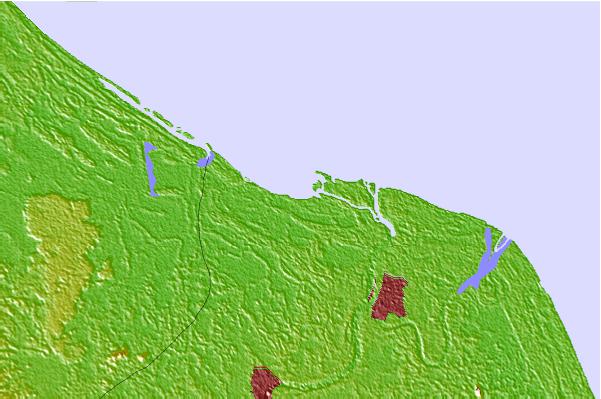
| Contours: | Roads & Rivers: | Select a
tide station / surf break / city |
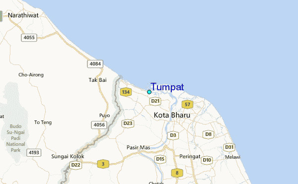
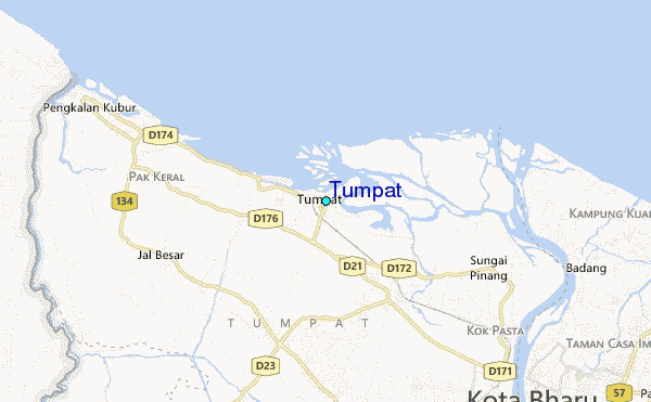
Use this relief map to navigate to tide stations, surf breaks and cities that are in the area of Tumpat.
Other Nearby Locations' tide tables and tide charts to Tumpat:
click location name for more details
 Surf breaks close to Tumpat:
|
||
|---|---|---|
| Closest surf break | Batu Buruk | 90 mi |
| Second closest surf break | Kelulut (Marang) | 102 mi |
| Third closest surf break | Songkhla - Fulerayem Point | 129 mi |
| Fourth closest surf break | Kijal | 157 mi |
| Fifth closest surf break | Cherating | 167 mi |


 Nearest
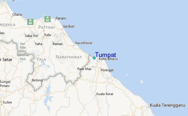