
| Distance / Altitude | Location | Report Date / Time | Live Weather | Wind | Gusts | Temp. | Visibility | Cloud |
|---|---|---|---|---|---|---|---|---|
| 45 km NW / 15 m | SHIP7579 (Marine) | 2024-04-28 20:00 local (2024/04/29 00:00 GMT) | fresh winds from the E (33.480000000000004 km/h at 90) | 26°C | 8.1 km | |||
| 80 km SW / 212 m | Camaguey/Ignacio Agramonte Internationa Airport (Cuba) | 2024-04-28 18:50 local (2024/04/28 22:50 GMT) | Dry and partly cloudy | fresh winds from the NE (33 km/h at 50) | 26°C | 9.0 | scattered | |
| 127 km SE / 208 m | Holguin Airport (Cuba) | 2024-04-28 18:50 local (2024/04/28 22:50 GMT) | - | moderate winds from the ENE (28 km/h at 70) | 27°C | 9.0 | few | |
| 156 km WNW / 4 m | Canagua Airport (Cuba) | 2024-04-28 18:50 local (2024/04/28 22:50 GMT) | Dry and partly cloudy | moderate winds from the E.(Wind varies from 070 to 130 degs) (26 km/h at 100) | 26°C | 9.0 | scattered | |
| 228 km SE / 209 m | Santiago De Cuba Airport (Cuba) | 2024-04-28 18:50 local (2024/04/28 22:50 GMT) | Dry and partly cloudy | light winds from the E.(Wind varies from 050 to 120 degs) (9 km/h at 90) | 29°C | 9.0 | scattered |
| Contours: | Roads & Rivers: | Select a
tide station / surf break / city |
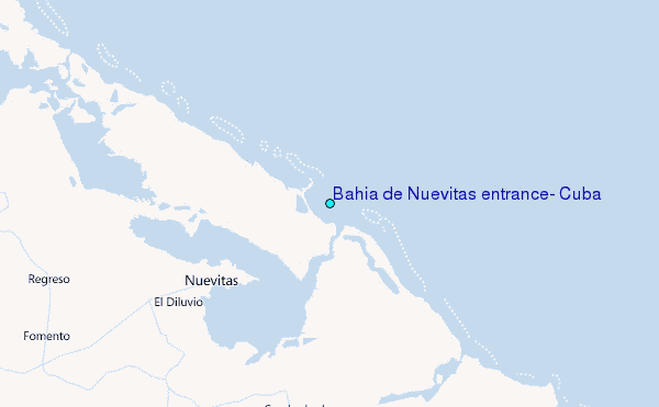
Use this relief map to navigate to tide stations, surf breaks and cities that are in the area of Bahía de Nuevitas entrance, Cuba.
Other Nearby Locations' tide tables and tide charts to Bahia de Nuevitas entrance, Cuba:
click location name for more details
 Surf breaks close to Bahia de Nuevitas entrance, Cuba:
|
||
|---|---|---|
| Closest surf break | Discovery Bay | 219 mi |
| Second closest surf break | Runaway Bay | 219 mi |
| Third closest surf break | Rock Sound | 232 mi |
| Fourth closest surf break | Peenie Wally | 237 mi |
| Fifth closest surf break | Paradise Island | 239 mi |

 Nearest
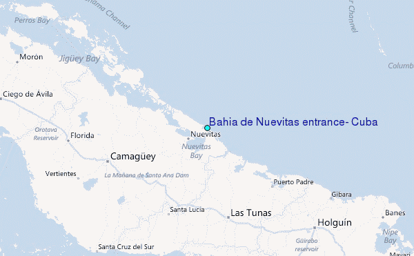