
| Distance / Altitude | Location | Report Date / Time | Live Weather | Wind | Gusts | Temp. | Visibility | Cloud |
|---|---|---|---|---|---|---|---|---|
| 95 km S / 217 m | Rankin Inlet Airport (N.w. Territories) | 2024-04-28 13:00 local (2024/04/28 17:00 GMT) | Dry and cloudy | light winds from the W (19 km/h at 280) | -12°C | 24 | overcast | |
| 166 km S / 250 m | Whale Cove Airport (N.w. Territories) | 2024-04-28 14:00 local (2024/04/28 18:00 GMT) | - | light winds from the S (19 km/h at 180) | — | 24 | ||
| 237 km W / 214 m | Baker Lake Airport (N.w. Territories) | 2024-04-28 13:00 local (2024/04/28 17:00 GMT) | Light snow | moderate winds from the WSW (20 km/h at 240) | -10°C | 24 | overcast | |
| 270 km NNE / 18 m | Wager Bay (Aut)- NU (Canada) | 2024-04-28 13:00 local (2024/04/28 17:00 GMT) | no report | fresh winds from the WNW (29 km/h at 290) | -16°C | - | - | |
| 271 km NNE / 18 m | Wager Bay (Nunavut) | 2024-04-28 13:00 local (2024/04/28 17:00 GMT) | - | fresh winds from the WNW (33 km/h at 290) | -16°C | 0.0 |
| Contours: | Roads & Rivers: | Select a
tide station / surf break / city |
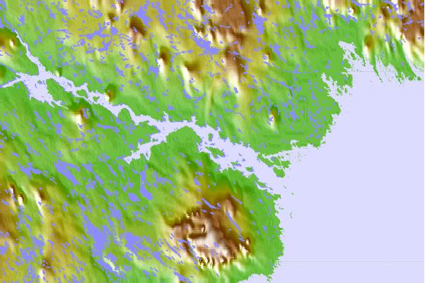
Use this relief map to navigate to tide stations, surf breaks and cities that are in the area of Deer Island, Nunavut.
Other Nearby Locations' tide tables and tide charts to Deer Island, Nunavut:
click location name for more details
 Surf breaks close to Deer Island, Nunavut:
|
||
|---|---|---|
| Closest surf break | Marathon | 1045 mi |
| Second closest surf break | Keweenaw Peninsula | 1124 mi |
| Third closest surf break | Apostle Islands | 1144 mi |
| Fourth closest surf break | Stoney Point | 1150 mi |
| Fifth closest surf break | Ontonagon | 1159 mi |

 Nearest