
| Distance / Altitude | Location | Report Date / Time | Live Weather | Wind | Gusts | Temp. | Visibility | Cloud |
|---|---|---|---|---|---|---|---|---|
| 48 km S / 2 m | Juanda Airport (Indonesia) | 2024-04-29 20:30 local (2024/04/29 13:30 GMT) | Dry and partly cloudy | light winds from the E (17 km/h at 80) | 30°C | 8.0 | scattered | |
| 260 km WSW / 5 m | Ahmad Yani International Airport (Indonesia) | 2024-04-29 20:30 local (2024/04/29 13:30 GMT) | Dry and partly cloudy | light winds from the SSE.(Wind varies from 120 to 200 degs) (6 km/h at 160) | 31°C | 6.0 | scattered | |
| 334 km SE / 216 m | Bali International Airport (Indonesia) | 2024-04-29 20:30 local (2024/04/29 13:30 GMT) | - | light winds from the ESE (17 km/h at 120) | 28°C | 10.0 | few | |
| 440 km ESE / 97 m | Bandara Airport (Indonesia) | 2024-04-29 20:30 local (2024/04/29 13:30 GMT) | Dry and partly cloudy | light winds from the SE (7 km/h at 130) | 26°C | 7.0 | broken | |
| 446 km NNE / 20 m | Syamsudin Noor International Airport (Indonesia) | 2024-04-29 20:30 local (2024/04/29 13:30 GMT) | - | calm (0 km/h at 0) | 28°C | 10.0 | few |
| Contours: | Roads & Rivers: | Select a
tide station / surf break / city |
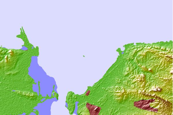
Use this relief map to navigate to tide stations, surf breaks and cities that are in the area of Karang Jamuang, Java, Indonesia.
Other Nearby Locations' tide tables and tide charts to Karang Jamuang, Java, Indonesia:
click location name for more details
 Surf breaks close to Karang Jamuang, Java, Indonesia:
|
||
|---|---|---|
| Closest surf break | Grajagan Bay/G-Land | 167 mi |
| Second closest surf break | Tanjung Kucur | 168 mi |
| Third closest surf break | Medewi | 177 mi |
| Fourth closest surf break | Balian | 188 mi |
| Fifth closest surf break | Pererenan | 203 mi |

 Nearest