
| Distance / Altitude | Location | Report Date / Time | Live Weather | Wind | Gusts | Temp. | Visibility | Cloud |
|---|---|---|---|---|---|---|---|---|
| 13 km ENE / 821 m | Kēōkea wx (United States) | 2024-05-02 14:20 local (2024/05/03 00:20 GMT) | dry | calm (2 km/h at 232) | 19°C | - | - - 0 | |
| 26 km NW / 235 m | Wailuku Heights wx (United States) | 2024-05-02 14:11 local (2024/05/03 00:11 GMT) | dry | moderate winds from the ENE (21 km/h at 74) | 23°C | - | - - 0 | |
| 28 km N / 3 m | BUOY-KLIH1 (Marine) | 2024-05-02 13:18 local (2024/05/02 23:18 GMT) | fresh winds from the ENE (33 km/h at 70) | 25°C | - | |||
| 28 km N / 218 m | Kahului Airport (Hawaii) | 2024-05-02 12:54 local (2024/05/02 22:54 GMT) | Dry and partly cloudy | fresh winds from the NE (35 km/h at 50) | 28°C | 16 | few scattered | |
| 30 km NNE / 312 m | Haiku (Hawaii) | 2024-05-02 13:31 local (2024/05/02 23:31 GMT) | dry | light winds from the ESE (14 km/h at 107) | 22°C | - | - - 0 |
| Contours: | Roads & Rivers: | Select a
tide station / surf break / city |
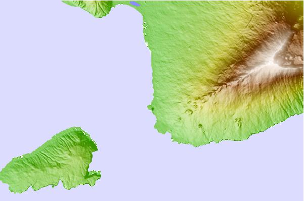
Use this relief map to navigate to tide stations, surf breaks and cities that are in the area of Makena, Maui Island, Hawaii.
Other Nearby Locations' tide tables and tide charts to Makena, Maui Island, Hawaii:
click location name for more details
 Surf breaks close to Makena, Maui Island, Hawaii:
|
||
|---|---|---|
| Closest surf break | Big Beach | 1 mi |
| Second closest surf break | Little Beach | 1 mi |
| Third closest surf break | Dumps | 2 mi |
| Fourth closest surf break | La Perouse Bay/The Dumps | 4 mi |
| Fifth closest surf break | Kihei Cove | 6 mi |

 Nearest