
| Distance / Altitude | Location | Report Date / Time | Live Weather | Wind | Gusts | Temp. | Visibility | Cloud |
|---|---|---|---|---|---|---|---|---|
| 54 km NNE / 12 m | Cam Ranh Bay Airport (Viet nam) | 2024-05-02 15:30 local (2024/05/02 08:30 GMT) | - | moderate winds from the SSE (26 km/h at 160) | — | 0.0 | ||
| 266 km SW / 218 m | Ho Chi Minh/Tan Son Nhat International Airport (Viet Nam) | 2024-05-02 15:30 local (2024/05/02 08:30 GMT) | - | light winds from the N (7 km/h at 1) | 38°C | 10.0 | few | |
| 323 km W / 23 m | Kratie (Cambodia) | 2024-05-02 15:00 local (2024/05/02 08:00 GMT) | - | calm (4 km/h at 150) | 38°C | - | no observation | |
| 323 km WNW / 330 m | Rattanakiri (Cambodia) | 2024-05-02 16:00 local (2024/05/02 09:00 GMT) | - | light winds from the SW (11 km/h at 230) | 37°C | - | no observation | |
| 352 km WSW / 6 m | Svay Rieng (Cambodia) | 2024-05-02 16:00 local (2024/05/02 09:00 GMT) | no report | calm (4 km/h at 230) | 37°C | - | - no observation - |
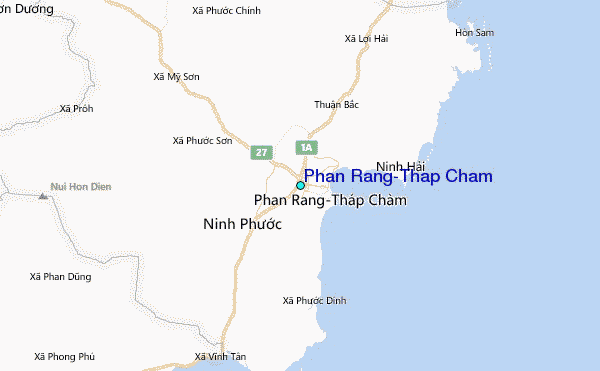
| Contours: | Roads & Rivers: | Select a
tide station / surf break / city |
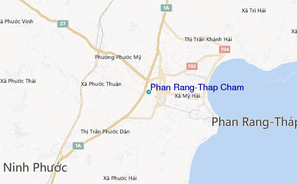
Use this relief map to navigate to tide stations, surf breaks and cities that are in the area of Phan Rang-Thap Cham.
Other Nearby Locations' tide tables and tide charts to Phan Rang-Thap Cham:
click location name for more details
 Surf breaks close to Phan Rang-Thap Cham:
|
||
|---|---|---|
| Closest surf break | Bai Dai Nha Trang | 40 mi |
| Second closest surf break | Dark Reef | 44 mi |
| Third closest surf break | Mui Ne | 64 mi |
| Fourth closest surf break | Vung Tau (Back Beach) | 154 mi |
| Fifth closest surf break | Cue Dai Beach | 302 mi |

 Nearest
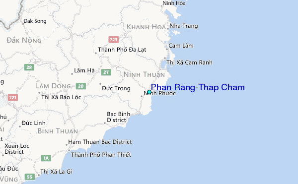