
| Distance / Altitude | Location | Report Date / Time | Live Weather | Wind | Gusts | Temp. | Visibility | Cloud |
|---|---|---|---|---|---|---|---|---|
| 3 km N / 45 m | Cronulla (Australia) | 2024-04-28 17:00 local (2024/04/28 07:00 GMT) | dry | light winds from the N (14 km/h at 3) | 21°C | - | - - 0 | |
| 7 km S / 44 m | Wattamolla Automatic Weather Station (Australia) | 2024-04-28 17:00 local (2024/04/28 07:00 GMT) | - | light winds from the N (17 km/h at 10) | — | - | no observation | |
| 10 km NNE / 4 m | Kurnell Automatic Weather Station (Australia) | 2024-04-28 17:00 local (2024/04/28 07:00 GMT) | - | fresh winds from the NE (30 km/h at 40) | — | - | no observation | |
| 10 km W / 80 m | Sydney (Australia) | 2024-04-28 17:28 local (2024/04/28 07:28 GMT) | dry | calm (0 km/h at 45) | 21°C | - | - - 0 | |
| 12 km NW / 20 m | Kogarah Bay (Australia) | 2024-04-28 17:11 local (2024/04/28 07:11 GMT) | dry | calm (0 km/h at ) | 21°C | - | - - 0 |
| Contours: | Roads & Rivers: | Select a
tide station / surf break / city |
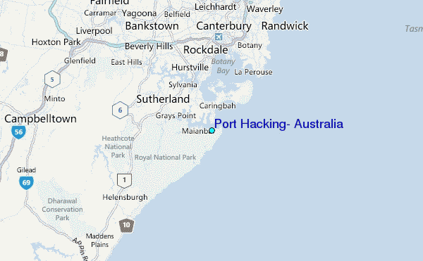
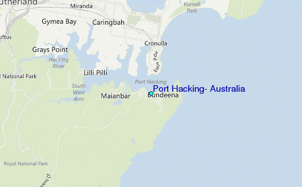
Use this relief map to navigate to tide stations, surf breaks and cities that are in the area of Port Hacking, Australia.
Other Nearby Locations' tide tables and tide charts to Port Hacking, Australia:
click location name for more details
 Surf breaks close to Port Hacking, Australia:
|
||
|---|---|---|
| Closest surf break | Cronulla Point | 2 mi |
| Second closest surf break | Cronulla -The Wall | 2 mi |
| Third closest surf break | Shark Island (Cronulla) | 2 mi |
| Fourth closest surf break | Cronulla | 2 mi |
| Fifth closest surf break | Elouera (Cronulla) | 2 mi |

 Nearest
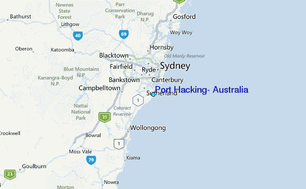