
| Distance / Altitude | Location | Report Date / Time | Live Weather | Wind | Gusts | Temp. | Visibility | Cloud |
|---|---|---|---|---|---|---|---|---|
| 8 km NE / 210 m | Tapachula Airport (Mexico) | 2024-05-06 16:41 local (2024/05/06 22:41 GMT) | Dry and partly cloudy | light winds from the SW (19 km/h at 230) | 33°C | 11 | scattered broken | |
| 22 km NE / 118 m | Tapachula-Chis (Mexico) | 2024-05-06 17:00 local (2024/05/06 23:00 GMT) | State of sky unchanged | light winds from the NE (7 km/h at 50) | 30°C | 50 km | - mostly cloudy - | |
| 80 km ESE / 367 m | Retalhuleu Airport/ (Guatemala) | 2024-05-06 16:00 local (2024/05/06 22:00 GMT) | Dry and partly cloudy | light winds from the SSW (11 km/h at 200) | 30°C | 10.0 | broken | |
| 84 km E / 1490 m | Guatemala (Guatemala) | 2024-05-06 17:30 local (2024/05/06 23:30 GMT) | dry | calm (0 km/h at 327) | 22°C | - | - - 0 | |
| 84 km E / 950 m | Guatemala (Guatemala) | 2024-05-06 17:38 local (2024/05/06 23:38 GMT) | dry | calm (0 km/h at 97) | 24°C | - | - - 0 |
| Contours: | Roads & Rivers: | Select a
tide station / surf break / city |

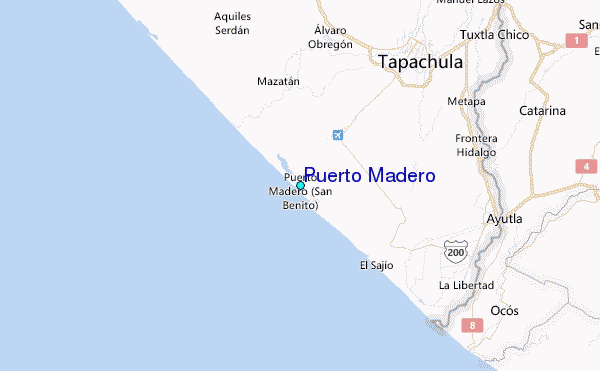
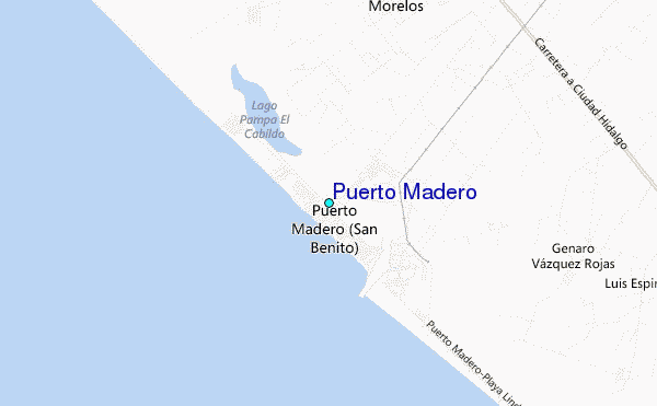
Use this relief map to navigate to tide stations, surf breaks and cities that are in the area of Puerto Madero.
Other Nearby Locations' tide tables and tide charts to Puerto Madero:
click location name for more details
 Surf breaks close to Puerto Madero:
|
||
|---|---|---|
| Closest surf break | Ocos | 17 mi |
| Second closest surf break | Tilapa | 19 mi |
| Third closest surf break | Puerto Madero | 31 mi |
| Fourth closest surf break | Champerico | 35 mi |
| Fifth closest surf break | Tulate | 54 mi |

 Nearest
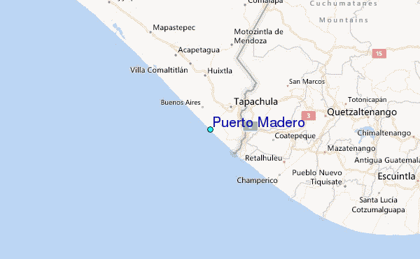