
| Distance / Altitude | Location | Report Date / Time | Live Weather | Wind | Gusts | Temp. | Visibility | Cloud |
|---|---|---|---|---|---|---|---|---|
| 8 km SE / 6 m | Renfrew (Antigua and Barbuda) | 2024-04-27 03:45 local (2024/04/27 07:45 GMT) | dry | calm (2 km/h at 219) | 26°C | - | - - 0 | |
| 9 km ESE / 211 m | Coolidge/Antigua Airport (Lesser Antilles) | 2024-04-27 03:00 local (2024/04/27 07:00 GMT) | Dry and partly cloudy | light winds from the E.(Wind varies from 040 to 140 degs) (9 km/h at 90) | 26°C | 10.0 | scattered broken | |
| 79 km WSW / 168 m | Jessups Village (Åland) | 2024-04-27 04:19 local (2024/04/27 08:19 GMT) | dry | calm (2 km/h at 27) | 24°C | - | - - 0 | |
| 102 km SSE / 22 m | Blanchet wx (Guadeloupe) | 2024-04-27 01:24 local (2024/04/27 05:24 GMT) | - | calm (0 km/h at 95) | 23°C | - | - - 0 | |
| 103 km SSE / 215 m | Le Raizet Airport (Lesser Antilles) | 2024-04-27 03:30 local (2024/04/27 07:30 GMT) | Light rain | light winds from the ESE (6 km/h at 120) | 24°C | 10.0 | few scattered overcast |
| Contours: | Roads & Rivers: | Select a
tide station / surf break / city |
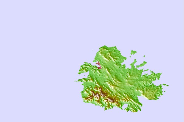
Use this relief map to navigate to tide stations, surf breaks and cities that are in the area of Saint Johns, Antigua.
Other Nearby Locations' tide tables and tide charts to Saint Johns, Antigua:
click location name for more details
 Surf breaks close to Saint Johns, Antigua:
|
||
|---|---|---|
| Closest surf break | Control Tower/Airport Reef | 32 mi |
| Second closest surf break | Farm bay | 32 mi |
| Third closest surf break | Rendezvous Point/Zen-Zone | 32 mi |
| Fourth closest surf break | Skwids | 32 mi |
| Fifth closest surf break | Trants Bay/Spleef Reef | 32 mi |

 Nearest