
| Distance / Altitude | Location | Report Date / Time | Live Weather | Wind | Gusts | Temp. | Visibility | Cloud |
|---|---|---|---|---|---|---|---|---|
| 11 km SSE / 3 m | BUOY-BMTW1 (Marine) | 2024-04-29 07:00 local (2024/04/29 14:00 GMT) | calm (4 km/h at 60) | 5°C | - | |||
| 17 km S / 537 m | Bremerton National Airport (Washington) | 2024-04-29 06:29 local (2024/04/29 13:29 GMT) | Light rain | calm (0 km/h at 0) | 4°C | 8 | overcast | |
| 19 km E / 3 m | BUOY-WPOW1 (Marine) | 2024-04-29 07:00 local (2024/04/29 14:00 GMT) | light winds from the SSE (11 km/h at 160) | 5°C | - | |||
| 23 km ENE / - m | SHIP7763 (ocean) | 2024-04-29 06:00 local (2024/04/29 13:00 GMT) | - | light winds from the SSW (7 km/h at 200) | 5°C | - | no observation | |
| 23 km ENE / - m | SHIP7726 (ocean) | 2024-04-29 06:00 local (2024/04/29 13:00 GMT) | - | light winds from the SSW (7 km/h at 200) | 5°C | - | no observation |
| Contours: | Roads & Rivers: | Select a
tide station / surf break / city |
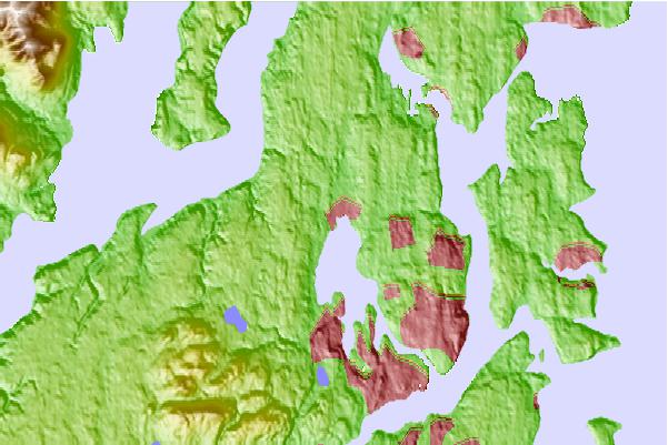
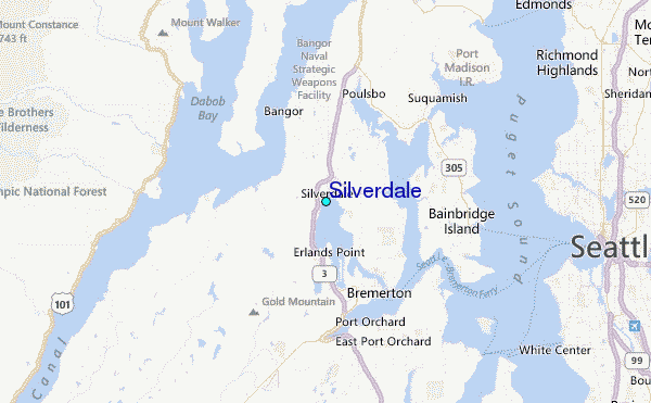
Use this relief map to navigate to tide stations, surf breaks and cities that are in the area of Silverdale.
Other Nearby Locations' tide tables and tide charts to Silverdale:
click location name for more details
 Surf breaks close to Silverdale:
|
||
|---|---|---|
| Closest surf break | Fort. Ebey | 40 mi |
| Second closest surf break | Super green | 43 mi |
| Third closest surf break | Elwha | 53 mi |
| Fourth closest surf break | Crescent | 59 mi |
| Fifth closest surf break | Whiskey Creek | 62 mi |

 Nearest
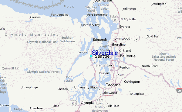