
| Distance / Altitude | Location | Report Date / Time | Live Weather | Wind | Gusts | Temp. | Visibility | Cloud |
|---|---|---|---|---|---|---|---|---|
| 7 km E / 217 m | Butterworth Airport (Malaysia) | 2024-04-29 10:00 local (2024/04/29 02:00 GMT) | - | light winds from the N (6 km/h at 1) | 30°C | 8.0 | few | |
| 18 km S / 4 m | Penang/Bayan Lepas Airport (Malaysia) | 2024-04-29 11:00 local (2024/04/29 03:00 GMT) | Haze | calm (4 km/h at 330) | 33°C | 28 km | mostly cloudy | |
| 20 km S / 218 m | Penang International Airport/Bayan Lepas (Malaysia) | 2024-04-29 10:30 local (2024/04/29 02:30 GMT) | - | light winds from the ENE.(Wind varies from 340 to 110 degs) (6 km/h at 60) | 32°C | 8.0 | few | |
| 82 km N / 5 m | Sultan Abdul Halim Airport (Malaysia) | 2024-04-29 11:00 local (2024/04/29 03:00 GMT) | Haze | calm (4 km/h at 1) | 30°C | 10.0 | few mostly cloudy - | |
| 113 km N / 22 m | Chuping (Malaysia) | 2024-04-29 11:00 local (2024/04/29 03:00 GMT) | Haze | calm (2 km/h at 30) | 32°C | 34 km | mostly cloudy |
| Contours: | Roads & Rivers: | Select a
tide station / surf break / city |
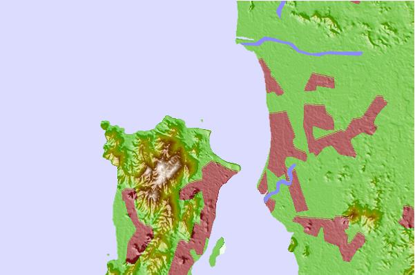
Use this relief map to navigate to tide stations, surf breaks and cities that are in the area of Tanjung Tokong.
Other Nearby Locations' tide tables and tide charts to Tanjung Tokong:
click location name for more details
 Surf breaks close to Tanjung Tokong:
|
||
|---|---|---|
| Closest surf break | Tengah Beach (Bank Negara) | 69 mi |
| Second closest surf break | Cenang Beach (The Cliff) | 70 mi |
| Third closest surf break | Songkhla - Fulerayem Point | 123 mi |
| Fourth closest surf break | Koh Lanta - Khlong Dao | 174 mi |
| Fifth closest surf break | Batu Buruk | 196 mi |

 Nearest