
| Distance / Altitude | Location | Report Date / Time | Live Weather | Wind | Gusts | Temp. | Visibility | Cloud |
|---|---|---|---|---|---|---|---|---|
| 4 km SW / 1 m | Jolly Roger Travel Park wx (United States) | 2024-04-28 15:48 local (2024/04/28 19:48 GMT) | dry | light winds from the S (10 km/h at 176) | 26°C | - | - - 0 | |
| 9 km NE / 3 m | BUOY-LONF1 (Marine) | 2024-04-28 15:20 local (2024/04/28 19:20 GMT) | fresh winds from the E (32 km/h at 100) | 25°C | - | |||
| 13 km SW / 5 m | Marathon (Florida) | 2024-04-28 15:16 local (2024/04/28 19:16 GMT) | dry | moderate winds from the ESE (21 km/h at 112) | 26°C | - | - - 0 | |
| 14 km SW / 217 m | Marathon Airport (Florida) | 2024-04-28 13:53 local (2024/04/28 17:53 GMT) | Dry and partly cloudy | fresh winds from the E (30 km/h at 90) | 27°C | 16 | few scattered scattered | |
| 15 km SW / 2 m | Castle Rock (Colorado) | 2024-04-28 15:47 local (2024/04/28 19:47 GMT) | dry | light winds from the NE (11 km/h at 49) | — | - | - - 0 |
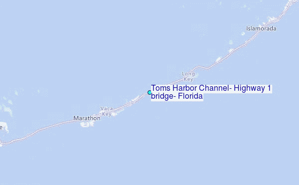
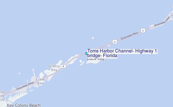
Choose Toms Harbor Channel, Highway 1 bridge, Florida Location Map Zoom:
| Contours: | Roads & Rivers: | Select a
tide station / surf break / city |


Use this relief map to navigate to tide stations, surf breaks and cities that are in the area of Toms Harbor Channel, Highway 1 bridge, Florida.
Other Nearby Locations' tide tables and tide charts to Toms Harbor Channel, Highway 1 bridge, Florida:
click location name for more details
 Surf breaks close to Toms Harbor Channel, Highway 1 bridge, Florida:
|
||
|---|---|---|
| Closest surf break | South Beach (Miami) | 85 mi |
| Second closest surf break | Fifth Street (Miami) | 85 mi |
| Third closest surf break | 21st Street (Miami) | 86 mi |
| Fourth closest surf break | Dunes Hotel (Miami) | 88 mi |
| Fifth closest surf break | Harbor House | 93 mi |

 Nearest
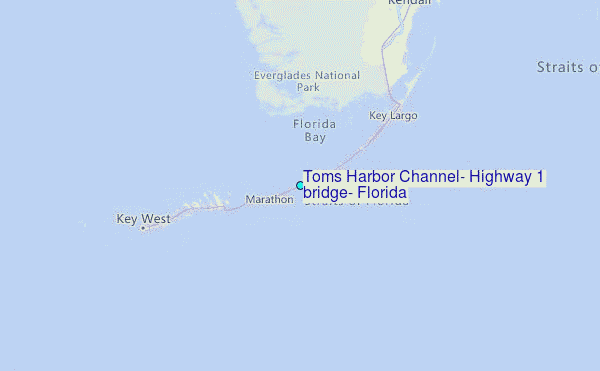