
| Distance / Altitude | Location | Report Date / Time | Live Weather | Wind | Gusts | Temp. | Visibility | Cloud |
|---|---|---|---|---|---|---|---|---|
| 96 km W / 15 m | ASCATB35E36N (Marine) | 2025-12-25 09:44 local (2025/12/25 06:44 GMT) | moderate winds from the ENE (21 km/h at 62) | — | - km | |||
| 134 km NNE / 71 m | Hatay Havalimanı (Turkey) | 2025-12-25 11:00 local (2025/12/25 08:00 GMT) | - | calm (0 km/h at 0) | — | 2.0 | no significant cloud - - | |
| 143 km SW / 15 m | ASCATB35E35N (Marine) | 2025-12-25 09:44 local (2025/12/25 06:44 GMT) | light winds from the E (15 km/h at 84) | — | - km | |||
| 157 km N / 119 m | Iskenderun (Turkey) | 2025-12-25 11:00 local (2025/12/25 08:00 GMT) | - | calm (2 km/h at 110) | — | 40 km | - scattered - | |
| 158 km S / 217 m | Beirut Airport (Lebanon) | 2025-12-25 10:00 local (2025/12/25 07:00 GMT) | - | light winds from the E (6 km/h at 100) | 18°C | 10.0 | few | |
| 158 km NE / 706 m | Aleppo Airport (Syria) | 2025-12-25 10:00 local (2025/12/25 07:00 GMT) | Fog - | calm (4 km/h at 110) | 5°C | 0.6 | ||
| 167 km WNW / 15 m | ASCATB34E36N (Marine) | 2025-12-25 09:44 local (2025/12/25 06:44 GMT) | light winds from the NNE (19 km/h at 21) | — | - km | |||
| 171 km NE / 455 m | AleppoMeselme (Syria) | 2025-12-25 09:00 local (2025/12/25 06:00 GMT) | Fog at a distance | calm (4 km/h at 350) | 6°C | 0.1 km | clear | |
| 183 km SW / 15 m | ASCATB34E35N (Marine) | 2025-12-25 09:44 local (2025/12/25 06:44 GMT) | moderate winds from the SE (24 km/h at 124) | — | - km | |||
| 200 km NNE / 638 m | Kilis (Turkey) | 2025-12-25 11:00 local (2025/12/25 08:00 GMT) | no report | calm (0 km/h at 70) | 13°C | 36 km | - no observation - |
| Contours: | Roads & Rivers: | Select a
tide station / surf break / city |
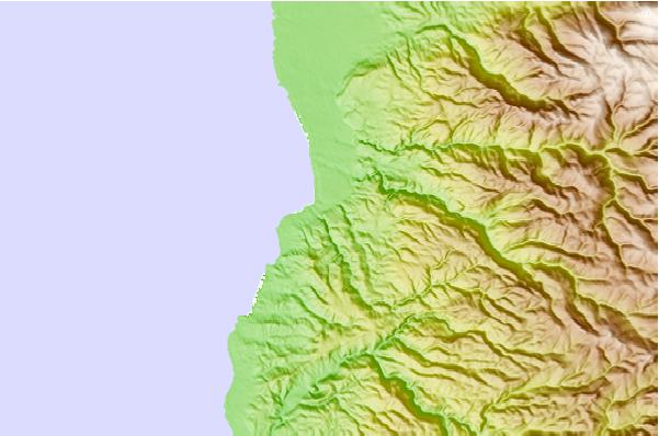
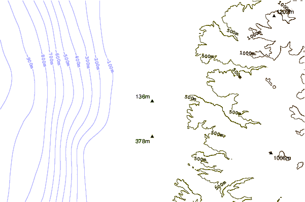
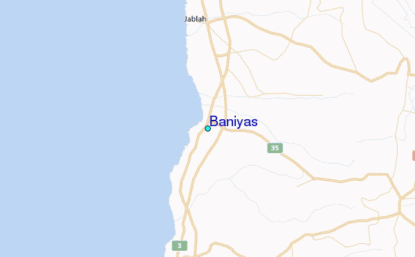
Use this relief map to navigate to tide stations, surf breaks and cities that are in the area of Baniyas.
Other Nearby Locations' tide tables and tide charts to Baniyas:
click location name for more details
 Surf breaks close to Baniyas:
|
||
|---|---|---|
| Closest surf break | Sandy Beach - Chekka | 62 mi |
| Second closest surf break | Batroun or Colonel | 67 mi |
| Third closest surf break | Tam Tam | 76 mi |
| Fourth closest surf break | Nahr Brahim | 80 mi |
| Fifth closest surf break | Phil and Did (Akif's reef) | 109 mi |


 Nearest
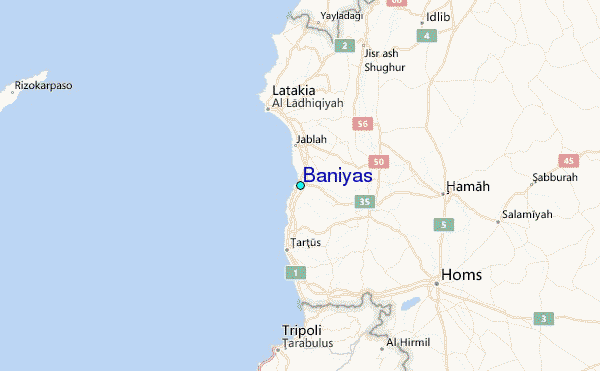