
| Distance / Altitude | Location | Report Date / Time | Live Weather | Wind | Gusts | Temp. | Visibility | Cloud |
|---|---|---|---|---|---|---|---|---|
| 25 km SW / 1 m | Ribnitz wx (Germany) | 2026-01-12 06:39 local (2026/01/12 05:39 GMT) | - | calm (3 km/h at 225) | -8°C | - | - - 0 | |
| 30 km SE / 16 m | Papenhagen wx (Germany) | 2026-01-12 06:07 local (2026/01/12 05:07 GMT) | - | light winds from the SE (6 km/h at 135) | -8°C | - | - - 0 | |
| 42 km SW / 1 m | Markgrafenheide wx (Germany) | 2026-01-12 06:22 local (2026/01/12 05:22 GMT) | - | calm (0 km/h at 0) | -6°C | - | - - 0 | |
| 47 km SW / 13 m | Warnemuende (Germany) | 2026-01-12 06:00 local (2026/01/12 05:00 GMT) | - | wind obs. (18 kph from 300 degs) was rejected (- km/h at -) | — | 30 | - - - | |
| 53 km ESE / 184 m | Greifswald (Germany) | 2026-01-12 06:00 local (2026/01/12 05:00 GMT) | - | wind obs. (11 kph from 260 degs) was rejected (- km/h at -) | — | 50 | - - - | |
| 56 km W / 5 m | Gedser (Denmark) | 2026-01-12 04:00 local (2026/01/12 03:00 GMT) | - | wind obs. (22 kph from 240 degs) was rejected (- km/h at -) | — | - | - | |
| 58 km S / 59 m | Laage(Flugplatz) (Germany) | 2026-01-12 06:00 local (2026/01/12 05:00 GMT) | - | light winds from the (7 km/h at 990) | -8°C | 40 km | no observation | |
| 58 km S / 217 m | Laage Airport (Germany) | 2026-01-12 05:20 local (2026/01/12 04:20 GMT) | - | light winds from the ESE (7 km/h at 110) | -9°C | 10.0 | ||
| 58 km NE / 42 m | Arkona (Germany) | 2026-01-12 06:00 local (2026/01/12 05:00 GMT) | - | wind obs. (29 kph from 270 degs) was rejected (- km/h at -) | — | 45 | - - - | |
| 60 km ESE / 1 m | Gahlkow wx (Germany) | 2026-01-12 06:41 local (2026/01/12 05:41 GMT) | - | calm (3 km/h at 236) | -9°C | - | - - 0 |
| Contours: | Roads & Rivers: | Select a
tide station / surf break / city |
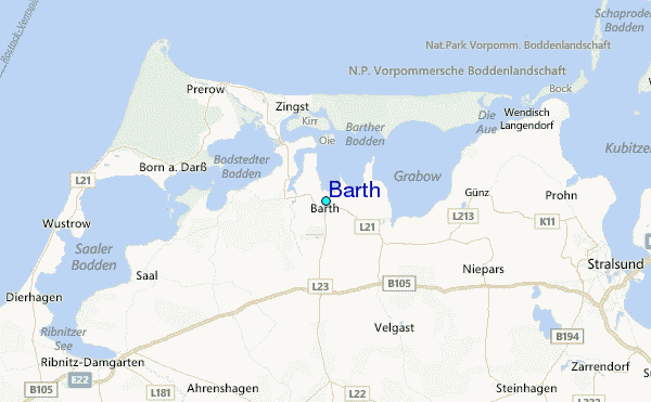
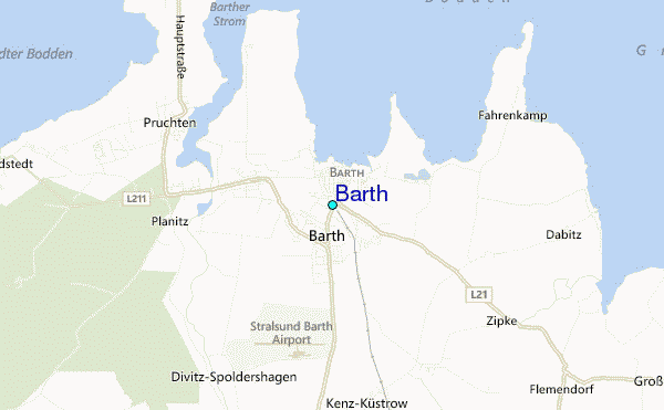
Use this relief map to navigate to tide stations, surf breaks and cities that are in the area of Barth.
Other Nearby Locations' tide tables and tide charts to Barth:
click location name for more details
 Surf breaks close to Barth:
|
||
|---|---|---|
| Closest surf break | Fehmarn | 64 mi |
| Second closest surf break | Pelzerhaken | 69 mi |
| Third closest surf break | Dazendorf | 73 mi |
| Fourth closest surf break | Hohwachter Bucht | 82 mi |
| Fifth closest surf break | Kåseberga | 88 mi |


 Nearest
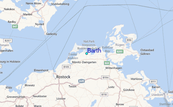