
| Distance / Altitude | Location | Report Date / Time | Live Weather | Wind | Gusts | Temp. | Visibility | Cloud |
|---|---|---|---|---|---|---|---|---|
| 14 km WNW / 0 m | lightning 15km NW of Weeki Wachee Gardens (United States) | 2026-06-11 18:20 local (2026/06/11 22:20 GMT) | Thunderstorm | (- km/h at -) | — | |||
| 17 km SE / 15 m | thunderstorm affecting Shady Hills (United States) | 2026-06-11 19:50 local (2026/06/11 23:50 GMT) | Thunderstorm | (- km/h at -) | — | |||
| 21 km ESE / 219 m | Brooksville Airport (Florida) | 2026-06-11 18:53 local (2026/06/11 22:53 GMT) | - | wind obs. (11 kph from 110 degs) was rejected (- km/h at -) | 30°C | 16 | few | |
| 32 km SSE / 21 m | lightning 8km NNW of Land O' Lakes (United States) | 2026-06-11 19:49 local (2026/06/11 23:49 GMT) | Thunderstorm | (- km/h at -) | — | |||
| 37 km S / 12 m | thunderstorm affecting Odessa (United States) | 2026-06-11 19:46 local (2026/06/11 23:46 GMT) | Thunderstorm | (- km/h at -) | — | |||
| 38 km NNE / 3 m | Crystal River Airport (Florida) (Florida) | 2026-06-11 19:35 local (2026/06/11 23:35 GMT) | Clear | wind obs. (6 kph from 300 degs) was rejected (- km/h at -) | 29°C | 16 | ||
| 44 km NE / 15 m | Inverness Airport (Florida) (Florida) | 2026-06-11 19:35 local (2026/06/11 23:35 GMT) | Dry and partly cloudy | wind obs. (6 kph from 160 degs) was rejected (- km/h at -) | 28°C | 11 | scattered | |
| 50 km SE / 22 m | lightning 5km SE of Wesley Chapel (United States) | 2026-06-11 18:16 local (2026/06/11 22:16 GMT) | Thunderstorm | (- km/h at -) | — | |||
| 51 km S / 3 m | lightning 4km S of East Lake (United States) | 2026-06-11 17:33 local (2026/06/11 21:33 GMT) | Thunderstorm | (- km/h at -) | — | |||
| 51 km S / 3 m | lightning 4km N of Oldsmar (United States) | 2026-06-11 17:47 local (2026/06/11 21:47 GMT) | Thunderstorm | (- km/h at -) | — |
| Contours: | Roads & Rivers: | Select a
tide station / surf break / city |
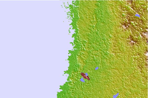
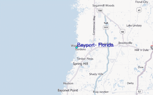
Use this relief map to navigate to tide stations, surf breaks and cities that are in the area of Bayport, Florida.
Other Nearby Locations' tide tables and tide charts to Bayport, Florida:
click location name for more details
 Surf breaks close to Bayport, Florida:
|
||
|---|---|---|
| Closest surf break | Anclote Island | 27 mi |
| Second closest surf break | Honeymoon Island | 31 mi |
| Third closest surf break | Clearwater Pass | 40 mi |
| Fourth closest surf break | Sand Key Park | 42 mi |
| Fifth closest surf break | Clearwater Beach | 42 mi |


 Nearest
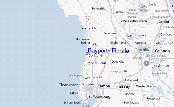