
| Distance / Altitude | Location | Report Date / Time | Live Weather | Wind | Gusts | Temp. | Visibility | Cloud |
|---|---|---|---|---|---|---|---|---|
| 181 km S / 9 m | Attawapiskat Airport (Canada) | 2026-04-11 18:00 local (2026/04/11 22:00 GMT) | Clear | light winds from the NE (13 km/h at 50) | -3°C | 14 | ||
| 236 km ESE / 195 m | LAGrandeRiviere A- Que (Canada) | 2026-04-11 17:00 local (2026/04/11 21:00 GMT) | - | moderate winds from the W (20 km/h at 260) | — | 2.0 km | - scattered - | |
| 236 km ESE / 217 m | La Grande Rivier Airport (Quebec) | 2026-04-11 18:15 local (2026/04/11 22:15 GMT) | Light snow | moderate winds from the WNW (20 km/h at 290) | -3°C | 6 | overcast | |
| 236 km ENE / 164 m | Kuujjuarapik Airport (Quebec) | 2026-04-11 18:36 local (2026/04/11 22:36 GMT) | Light snow | light winds from the NW (6 km/h at 310) | -12°C | 14 | broken | |
| 237 km ENE / 12 m | Kuujjuarapik Arpt (Canada) | 2026-04-11 19:00 local (2026/04/11 23:00 GMT) | - | calm (4 km/h at 310) | — | - | - | |
| 269 km NNE / 34 m | Sanikiluaq (Canada) | 2026-04-11 19:00 local (2026/04/11 23:00 GMT) | - | wind obs. (40 kph from 260 degs) was rejected (- km/h at -) | — | - | - - - | |
| 290 km W / 11 m | Peawanuck (Aut)- Ont (Canada) | 2026-04-11 19:00 local (2026/04/11 23:00 GMT) | Clear | light winds from the S.(Wind varies from 140 to 220 degs) (13 km/h at 190) | -4°C | 14 | - - - | |
| 341 km S / 9 m | Moosonee Airport (Ontario) | 2026-04-11 19:00 local (2026/04/11 23:00 GMT) | no report | light winds from the W (11 km/h at 280) | 8°C | 0.0 | - - - | |
| 344 km S / 217 m | Moosonee Airport (Ontario) | 2026-04-11 18:00 local (2026/04/11 22:00 GMT) | Clear | moderate winds from the WNW (22 km/h at 290) | 7°C | 14 | ||
| 376 km NE / 273 m | Umiujaq Airport (Quebec) | 2026-04-11 17:00 local (2026/04/11 21:00 GMT) | - | moderate winds from the NW (22 km/h at 320) | -12°C | 24 | few |
| Contours: | Roads & Rivers: | Select a
tide station / surf break / city |
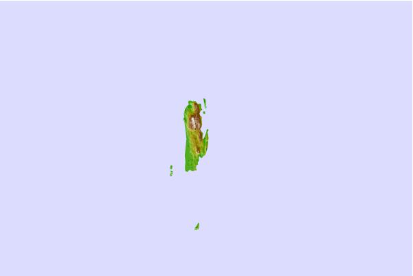

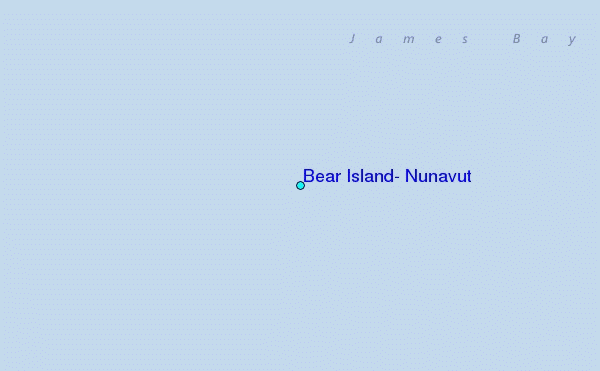
Use this relief map to navigate to tide stations, surf breaks and cities that are in the area of Bear Island, Nunavut.
Other Nearby Locations' tide tables and tide charts to Bear Island, Nunavut:
click location name for more details
 Surf breaks close to Bear Island, Nunavut:
|
||
|---|---|---|
| Closest surf break | Marathon | 454 mi |
| Second closest surf break | Alona Bay | 521 mi |
| Third closest surf break | Keweenaw Peninsula | 567 mi |
| Fourth closest surf break | Au Sable Point | 575 mi |
| Fifth closest surf break | Grand Marias | 575 mi |


 Nearest
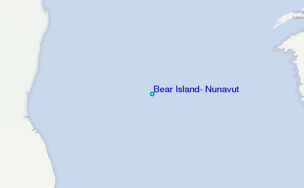