
| Distance / Altitude | Location | Report Date / Time | Live Weather | Wind | Gusts | Temp. | Visibility | Cloud |
|---|---|---|---|---|---|---|---|---|
| 18 km NE / 20 m | Kaseda-shirakame wx (Japan) | 2026-07-10 10:06 local (2026/07/10 01:06 GMT) | - | light winds from the E (16 km/h at 95) | 30°C | - | - - 0 | |
| 74 km NE / 474 m | Kagoshima Airport (Japan) | 2026-07-10 09:00 local (2026/07/10 00:00 GMT) | Dry and partly cloudy | moderate winds from the E.(Wind varies from 060 to 140 degs) (20 km/h at 90) | 27°C | 10.0 | scattered - - | |
| 106 km SE / 328 m | Tanegashima Airport (Japan) | 2026-07-10 09:00 local (2026/07/10 00:00 GMT) | Dry and partly cloudy | moderate winds from the ESE (24 km/h at 110) | 27°C | 10.0 | few scattered broken | |
| 125 km N / 93 m | Kuratake (Japan) | 2026-07-10 10:00 local (2026/07/10 01:00 GMT) | - | light winds from the E (9 km/h at 93) | 31°C | - | - - 0 | |
| 132 km ENE / 475 m | Miyazaki Airport (Japan) | 2026-07-10 09:00 local (2026/07/10 00:00 GMT) | Shower light rain shower | light winds from the NE (19 km/h at 50) | — | 5.0 | few scattered | |
| 180 km NNE / 474 m | Kumamoto Airport (Japan) | 2026-07-10 09:00 local (2026/07/10 00:00 GMT) | - | light winds from the E.(Wind varies from 040 to 140 degs) (9 km/h at 80) | 30°C | 10.0 | few | |
| 182 km WNW / 0 m | lightning 53km SSW of Fukue (Japan) | 2026-07-10 08:19 local (2026/07/09 23:19 GMT) | Thunderstorm | (- km/h at -) | — | |||
| 183 km N / 474 m | Nagasaki Airport (Japan) | 2026-07-10 09:00 local (2026/07/10 00:00 GMT) | - | light winds from the N (6 km/h at 1) | 30°C | 10.0 | few - - | |
| 197 km NW / 15 m | SHIP6074 (Marine) | 2026-07-10 09:00 local (2026/07/10 00:00 GMT) | - (- km/h at -) | — | - km | |||
| 197 km NW / 15 m | SHIP2707 (Marine) | 2026-07-10 08:00 local (2026/07/09 23:00 GMT) | - (- km/h at -) | — | - km |
| Contours: | Roads & Rivers: | Select a
tide station / surf break / city |
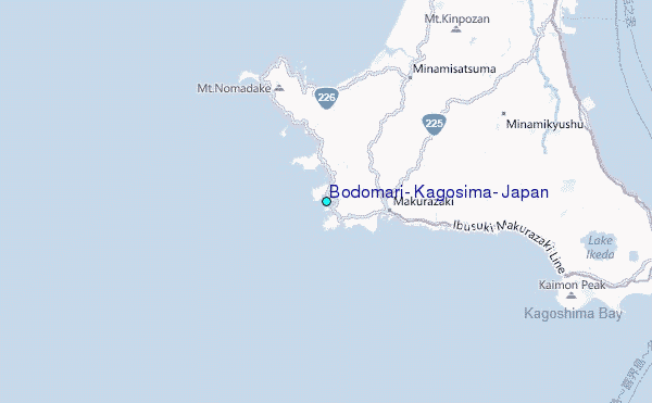
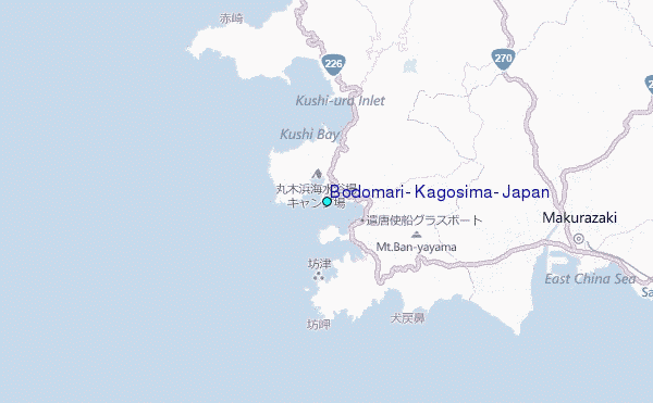
Use this relief map to navigate to tide stations, surf breaks and cities that are in the area of Bodomari, Kagosima, Japan.
Other Nearby Locations' tide tables and tide charts to Bodomari, Kagosima, Japan:
click location name for more details
 Surf breaks close to Bodomari, Kagosima, Japan:
|
||
|---|---|---|
| Closest surf break | Nagata | 61 mi |
| Second closest surf break | Cape Toi | 67 mi |
| Third closest surf break | Kojima | 69 mi |
| Fourth closest surf break | Nichinan | 74 mi |
| Fifth closest surf break | Unnamed | 75 mi |


 Nearest
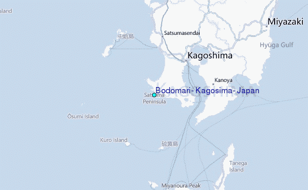