
| Distance / Altitude | Location | Report Date / Time | Live Weather | Wind | Gusts | Temp. | Visibility | Cloud |
|---|---|---|---|---|---|---|---|---|
| 194 km ESE / 56 m | Malabo/Fernando Poo Airport (Equatorial Guinea) | 2026-04-15 01:00 local (2026/04/15 00:00 GMT) | state of sky unchanged | light winds from the SW (11 km/h at 220) | 30°C | 10 | - - - | |
| 487 km W / 194 m | Lagos/ikeja Airport (Nigeria) | 2026-04-15 01:00 local (2026/04/15 00:00 GMT) | - | light winds from the WSW (6 km/h at 250) | 28°C | 30 km | few mostly cloudy - | |
| 490 km NE / 299 m | lightning 34km NW of Baissa (Nigeria) | 2026-04-14 23:50 local (2026/04/14 22:50 GMT) | Thunderstorm | (- km/h at -) | — | |||
| 508 km SSE / 218 m | Libreville/Leon M'Ba Airport (Gabon) | 2026-04-15 01:00 local (2026/04/15 00:00 GMT) | no report | wind obs. (7 kph from 140 degs) was rejected (- km/h at -) | 25°C | 10 | few - - | |
| 571 km W / 213 m | Cotonou/Cadjehoun Airport (Benin) | 2026-04-15 00:00 local (2026/04/14 23:00 GMT) | - | light winds from the SW (19 km/h at 230) | 29°C | 10.0 | few | |
| 583 km ESE / 552 m | Oyem (Woleu-Ntem) (Gabon) | 2026-04-15 01:00 local (2026/04/15 00:00 GMT) | no report | - (- km/h at -) | 25°C | 10 | - | |
| 596 km SSE / 4 m | Port Gentil (Gabon) | 2026-04-15 01:00 local (2026/04/15 00:00 GMT) | no report | light winds from the SSW (19 km/h at 200) | 27°C | 8 | - | |
| 596 km SSE / 33 m | Port Gentil Airport (Gabon) | 2026-04-15 01:00 local (2026/04/15 00:00 GMT) | no report | light winds from the SSW (19 km/h at 200) | 27°C | 8 | scattered - - | |
| 664 km SSE / 2 m | Lambarene Airport (Gabon) | 2026-04-15 01:00 local (2026/04/15 00:00 GMT) | no report | calm (0 km/h at 0) | — | 9 | scattered - - | |
| 671 km W / 32 m | Tabligbo (Togo) | 2026-04-15 01:00 local (2026/04/15 00:00 GMT) | no report | - (- km/h at -) | 26°C | 10 | - |
| Contours: | Roads & Rivers: | Select a
tide station / surf break / city |
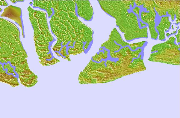
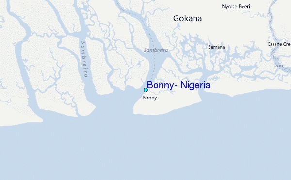
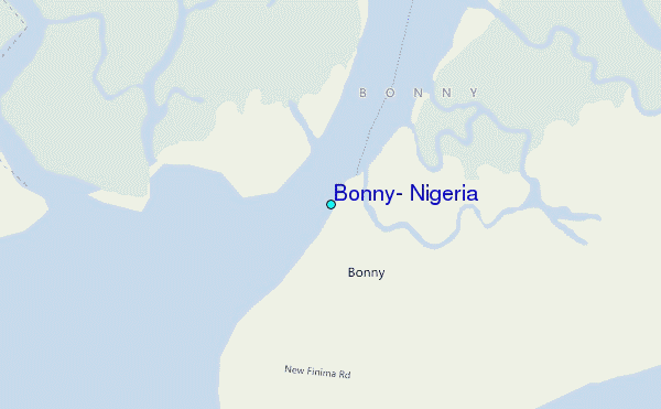
Use this relief map to navigate to tide stations, surf breaks and cities that are in the area of Bonny, Nigeria.
Other Nearby Locations' tide tables and tide charts to Bonny, Nigeria:
click location name for more details
 Surf breaks close to Bonny, Nigeria:
|
||
|---|---|---|
| Closest surf break | Seme Beach Limbe | 139 mi |
| Second closest surf break | Kribi | 216 mi |
| Third closest surf break | Lighthouse Beach | 292 mi |
| Fourth closest surf break | Tarqua Bay | 293 mi |
| Fifth closest surf break | Shipwreck | 308 mi |


 Nearest
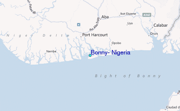