
| Distance / Altitude | Location | Report Date / Time | Live Weather | Wind | Gusts | Temp. | Visibility | Cloud |
|---|---|---|---|---|---|---|---|---|
| 4 km W / 15 m | ASCATB300E47N (Marine) | 2026-04-26 10:09 local (2026/04/26 13:09 GMT) | strong winds from the NNW (44 km/h at 338) | — | - km | |||
| 10 km SSE / 15 m | SHIP2181 (Marine) | 2026-04-26 11:00 local (2026/04/26 14:00 GMT) | near gales from the NNW (59.4 km/h at 330) | — | - km | |||
| 22 km E / 15 m | ASCATB301E47N (Marine) | 2026-04-26 10:09 local (2026/04/26 13:09 GMT) | strong winds from the NNW (42 km/h at 337) | — | - km | |||
| 10 km SSE / 3 m | SHIP6469 (Marine) | 2026-04-26 11:00 local (2026/04/26 14:00 GMT) | near gales from the NNW (59 km/h at 330) | 2°C | - | |||
| 10 km SSE / 3 m | SHIP3365 (Marine) | 2026-04-26 11:00 local (2026/04/26 14:00 GMT) | near gales from the NNW (59 km/h at 330) | 2°C | - | |||
| 10 km SSE / 3 m | SHIP1815 (Marine) | 2026-04-26 11:00 local (2026/04/26 14:00 GMT) | near gales from the NNW (59 km/h at 330) | 2°C | - | |||
| 14 km NW / 3 m | SHIP2046 (Marine) | 2026-04-26 12:00 local (2026/04/26 15:00 GMT) | near gales from the NW (58 km/h at 320) | 1°C | - | |||
| 22 km E / 15 m | ASCATB301E47N (Marine) | 2026-04-26 10:09 local (2026/04/26 13:09 GMT) | strong winds from the NNW (42 km/h at 337) | — | - km | |||
| 34 km SSE / 15 m | SHIP10353 (Marine) | 2026-04-26 10:00 local (2026/04/26 13:00 GMT) | strong winds from the NNW (46.440000000000005 km/h at 330) | — | - km | |||
| 34 km SSE / 3 m | SHIP2095 (Marine) | 2026-04-26 10:00 local (2026/04/26 13:00 GMT) | strong winds from the NNW (46 km/h at 330) | 2°C | - |
| Contours: | Roads & Rivers: | Select a
tide station / surf break / city |

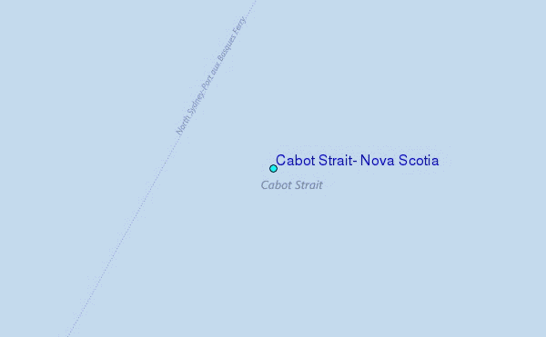
Use this relief map to navigate to tide stations, surf breaks and cities that are in the area of Cabot Strait, Nova Scotia.
Other Nearby Locations' tide tables and tide charts to Cabot Strait, Nova Scotia:
click location name for more details
 Surf breaks close to Cabot Strait, Nova Scotia:
|
||
|---|---|---|
| Closest surf break | Ingonish Beach | 30 mi |
| Second closest surf break | Kennington Cove | 51 mi |
| Third closest surf break | Michaud Point | 83 mi |
| Fourth closest surf break | Martinique | 211 mi |
| Fifth closest surf break | Lawrencetown Left Point | 219 mi |


 Nearest
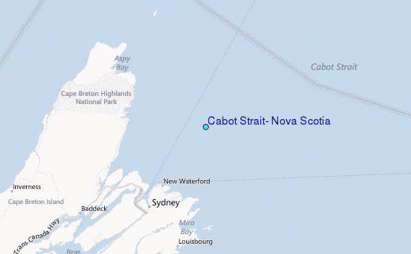