
| Distance / Altitude | Location | Report Date / Time | Live Weather | Wind | Gusts | Temp. | Visibility | Cloud |
|---|---|---|---|---|---|---|---|---|
| 6 km NE / 194 m | Iles de la madel Airport (Quebec) | 2025-12-24 07:00 local (2025/12/24 11:00 GMT) | - | light winds from the N (17 km/h at 10) | -7°C | 0.0 | ||
| 7 km ENE / 11 m | Iles DE LA Madeleine A- Que (Canada) | 2025-12-24 08:00 local (2025/12/24 12:00 GMT) | Continuous light snow | light winds from the NNE (13 km/h at 30) | -7°C | 50 km | - overcast - | |
| 8 km ENE / 163 m | Iles DE LA Madel Airport (Quebec) | 2025-12-24 07:00 local (2025/12/24 11:00 GMT) | Light snow | light winds from the NNE (15 km/h at 20) | -7°C | 24 | overcast | |
| 101 km SE / 42 m | Pleasant Bay (Canada) | 2025-12-24 08:04 local (2025/12/24 12:04 GMT) | - | light winds from the NNE (10 km/h at 29) | -6°C | - | - - 0 | |
| 102 km SE / 303 m | Pleasant Bay wx (Canada) | 2025-12-24 08:35 local (2025/12/24 12:35 GMT) | - | calm (5 km/h at 34) | -9°C | - | - - 0 | |
| 103 km S / 8 m | East Point (Aut)- Pei (Canada) | 2025-12-24 08:00 local (2025/12/24 12:00 GMT) | no report | moderate winds from the N (20 km/h at 10) | -7°C | - | - no observation - | |
| 104 km S / 217 m | East Point Airport (Prince Edward Islan) | 2025-12-24 07:00 local (2025/12/24 11:00 GMT) | - | moderate winds from the NNE (20 km/h at 30) | -6°C | 0.0 | ||
| 105 km SE / 11 m | Cheticamp (Canada) | 2025-12-24 08:23 local (2025/12/24 12:23 GMT) | - | calm (5 km/h at 50) | -7°C | - | - - 0 | |
| 106 km SE / 8 m | La Pointe wx (Canada) | 2025-12-24 08:13 local (2025/12/24 12:13 GMT) | - | light winds from the NNE (6 km/h at 21) | -7°C | - | - - 0 | |
| 107 km SE / 14 m | La Prairie wx (Canada) | 2025-12-24 08:20 local (2025/12/24 12:20 GMT) | - | calm (0 km/h at 0) | -7°C | - | - - 0 |
| Contours: | Roads & Rivers: | Select a
tide station / surf break / city |
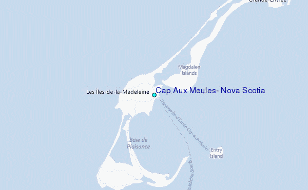
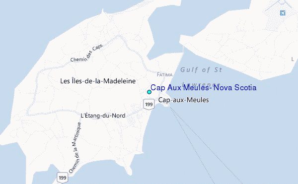
Use this relief map to navigate to tide stations, surf breaks and cities that are in the area of Cap Aux Meules, Nova Scotia.
Other Nearby Locations' tide tables and tide charts to Cap Aux Meules, Nova Scotia:
click location name for more details
 Surf breaks close to Cap Aux Meules, Nova Scotia:
|
||
|---|---|---|
| Closest surf break | Ingonish Beach | 87 mi |
| Second closest surf break | Kennington Cove | 135 mi |
| Third closest surf break | Michaud Point | 137 mi |
| Fourth closest surf break | Martinique | 196 mi |
| Fifth closest surf break | Lawrencetown Left Point | 202 mi |


 Nearest
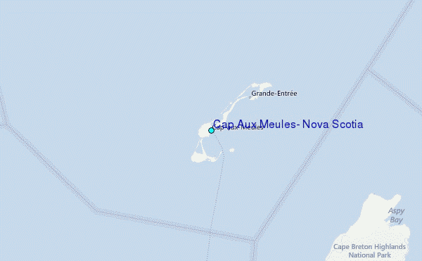