
| Distance / Altitude | Location | Report Date / Time | Live Weather | Wind | Gusts | Temp. | Visibility | Cloud |
|---|---|---|---|---|---|---|---|---|
| 35 km N / 217 m | Mary's Harbour Airport (Newfoundland) | 2025-12-25 03:30 local (2025/12/25 07:00 GMT) | Clear | light winds from the WSW (7 km/h at 250) | -23°C | 14 | ||
| 38 km N / 12 m | Mary s Harbour- Nfld (Canada) | 2025-12-25 02:30 local (2025/12/25 06:00 GMT) | - | moderate winds from the WSW (22 km/h at 250) | — | - | - | |
| 56 km SSE / 10 m | St. Lunaire - Griquet (Canada) | 2025-12-25 04:39 local (2025/12/25 08:09 GMT) | dry | calm (3 km/h at 298) | — | - | - - 0 | |
| 66 km S / 33 m | St.Anthony-Nfld (Canada) | 2025-12-25 04:30 local (2025/12/25 08:00 GMT) | - | wind obs. (40 kph from 230 degs) was rejected (- km/h at -) | — | 36 km | - clear - | |
| 67 km S / 196 m | Saint Anthony Airport (Newfoundland) | 2025-12-25 03:37 local (2025/12/25 07:07 GMT) | Dry and cloudy | light winds from the S (13 km/h at 190) | -17°C | 14 | scattered overcast | |
| 108 km SW / 216 m | Blanc Sablon Airport (Quebec) | 2025-12-25 03:30 local (2025/12/25 07:00 GMT) | - | light winds from the NE.(Wind varies from 010 to 070 degs) (11 km/h at 50) | — | 24 | ||
| 109 km SW / 37 m | LourdesDEBlanc Sablon A- Que (Canada) | 2025-12-25 04:30 local (2025/12/25 08:00 GMT) | - | light winds from the N (13 km/h at 10) | — | 44 km | - clear - | |
| 137 km SSW / 6 m | FerollePoint(Aut)- Nfld (Canada) | 2025-12-25 02:30 local (2025/12/25 06:00 GMT) | - | strong winds from the SSW (50 km/h at 200) | — | - | - no observation - | |
| 137 km SSW / 216 m | Ferolle Point Airport (Newfoundland) | 2025-12-25 03:30 local (2025/12/25 07:00 GMT) | - | calm (4 km/h at 260) | -8°C | 0.0 | ||
| 140 km S / 30 m | Englee (Aut)- Nfld (Canada) | 2025-12-25 02:30 local (2025/12/25 06:00 GMT) | - | wind obs. (47 kph from 280 degs) was rejected (- km/h at -) | — | - | - - - |
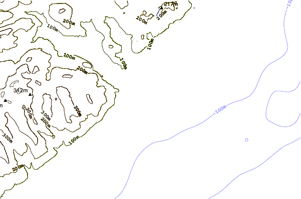
| Contours: | Roads & Rivers: | Select a
tide station / surf break / city |
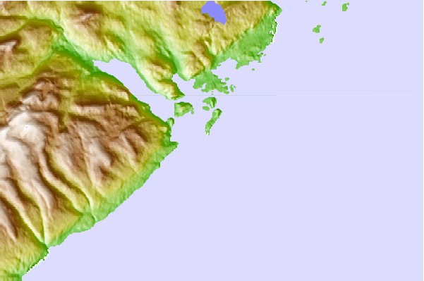
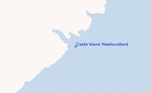
Use this relief map to navigate to tide stations, surf breaks and cities that are in the area of Castle Island, Newfoundland.
Other Nearby Locations' tide tables and tide charts to Castle Island, Newfoundland:
click location name for more details
 Surf breaks close to Castle Island, Newfoundland:
|
||
|---|---|---|
| Closest surf break | Ingonish Beach | 421 mi |
| Second closest surf break | Kennington Cove | 462 mi |
| Third closest surf break | Michaud Point | 494 mi |
| Fourth closest surf break | Martinique | 605 mi |
| Fifth closest surf break | Lawrencetown Left Point | 612 mi |


 Nearest
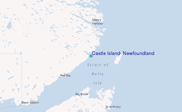