
| Distance / Altitude | Location | Report Date / Time | Live Weather | Wind | Gusts | Temp. | Visibility | Cloud |
|---|---|---|---|---|---|---|---|---|
| 95 km ENE / 3 m | La Have Bank Buoy (Marine) | 2026-07-26 11:00 local (2026/07/26 14:00 GMT) | fresh winds from the NE (29 km/h at 50) | 17°C | - | |||
| 152 km NW / 6 m | Baccaro Pt- NS (Canada) | 2026-07-26 10:00 local (2026/07/26 13:00 GMT) | no report | wind obs. (18 kph from 260 degs) was rejected (- km/h at -) | 13°C | - | - - - | |
| 169 km SSW / 3 m | Georges Bank 170 NM East of Hyannis- MA (Marine) | 2026-07-26 10:50 local (2026/07/26 13:50 GMT) | moderate winds from the ENE (25 km/h at 60) | 21°C | - | |||
| 199 km N / 3 m | SHIP7310 (Marine) | 2026-07-26 09:00 local (2026/07/26 12:00 GMT) | moderate winds from the E (24 km/h at 80) | 15°C | - | |||
| 199 km N / 3 m | SHIP2599 (Marine) | 2026-07-26 09:00 local (2026/07/26 12:00 GMT) | moderate winds from the E (24 km/h at 80) | 15°C | - | |||
| 199 km N / 15 m | SHIP2535 (Marine) | 2026-07-26 09:00 local (2026/07/26 12:00 GMT) | moderate winds from the E (24.12 km/h at 80) | — | - km | |||
| 199 km N / 3 m | SHIP174 (Marine) | 2026-07-26 09:00 local (2026/07/26 12:00 GMT) | moderate winds from the E (24 km/h at 80) | 15°C | - | |||
| 199 km N / 15 m | SHIP9901 (Marine) | 2026-07-26 09:00 local (2026/07/26 12:00 GMT) | moderate winds from the E (24.12 km/h at 80) | — | - km | |||
| 199 km N / 15 m | SHIP4059 (Marine) | 2026-07-26 09:00 local (2026/07/26 12:00 GMT) | moderate winds from the E (24.12 km/h at 80) | — | - km | |||
| 199 km N / 3 m | SHIP1134 (Marine) | 2026-07-26 10:00 local (2026/07/26 13:00 GMT) | moderate winds from the E (21 km/h at 90) | 15°C | - |

| Contours: | Roads & Rivers: | Select a
tide station / surf break / city |

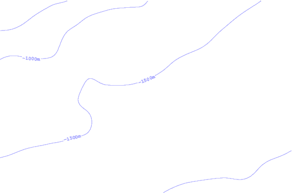
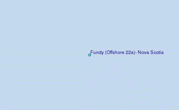
Use this relief map to navigate to tide stations, surf breaks and cities that are in the area of Fundy (Offshore 22a), Nova Scotia.
Other Nearby Locations' tide tables and tide charts to Fundy (Offshore 22a), Nova Scotia:
click location name for more details
 Surf breaks close to Fundy (Offshore 22a), Nova Scotia:
|
||
|---|---|---|
| Closest surf break | Summerville | 126 mi |
| Second closest surf break | White Point Beach | 128 mi |
| Third closest surf break | Scotts Bay | 130 mi |
| Fourth closest surf break | Western Head Point | 131 mi |
| Fifth closest surf break | Western Head Reef | 131 mi |


 Nearest