
| Distance / Altitude | Location | Report Date / Time | Live Weather | Wind | Gusts | Temp. | Visibility | Cloud |
|---|---|---|---|---|---|---|---|---|
| 12 km ESE / 46 m | NewCarlisle1- Que (Canada) | 2025-12-24 06:00 local (2025/12/24 11:00 GMT) | - | wind obs. (7 kph from 290 degs) was rejected (- km/h at -) | — | - | - no observation - | |
| 13 km E / 196 m | New Carlisle Airport (Quebec) | 2025-12-24 05:00 local (2025/12/24 10:00 GMT) | - | light winds from the N (7 km/h at 10) | -11°C | 0.0 | ||
| 47 km ENE / 15 m | SHIP4328 (Marine) | 2025-12-24 04:00 local (2025/12/24 09:00 GMT) | light winds from the NNW (9.360000000000001 km/h at 330) | — | - km | |||
| 49 km S / 59 m | Bathurst Airport (Canada) | 2025-12-24 06:00 local (2025/12/24 11:00 GMT) | - | light winds from the W (11 km/h at 260) | — | 36 km | - overcast - | |
| 50 km S / 217 m | Bathurst Airport (New Brunswick) | 2025-12-24 05:00 local (2025/12/24 10:00 GMT) | Dry and cloudy | calm (0 km/h at 0) | -14°C | 14 | overcast | |
| 47 km ENE / 3 m | SHIP4864 (Marine) | 2025-12-24 04:00 local (2025/12/24 09:00 GMT) | light winds from the NNW (9 km/h at 330) | — | - | |||
| 47 km ENE / 15 m | SHIP5589 (Marine) | 2025-12-24 04:00 local (2025/12/24 09:00 GMT) | light winds from the NNW (9.360000000000001 km/h at 330) | — | - km | |||
| 47 km ENE / 15 m | SHIP3926 (Marine) | 2025-12-24 05:00 local (2025/12/24 10:00 GMT) | light winds from the N (12.96 km/h at 0) | — | - km | |||
| 47 km ENE / 3 m | SHIP7311 (Marine) | 2025-12-24 04:00 local (2025/12/24 09:00 GMT) | light winds from the NNW (9 km/h at 330) | — | - | |||
| 47 km ENE / 15 m | SHIP2716 (Marine) | 2025-12-24 04:00 local (2025/12/24 09:00 GMT) | light winds from the N (12.96 km/h at 360) | — | - km |
| Contours: | Roads & Rivers: | Select a
tide station / surf break / city |

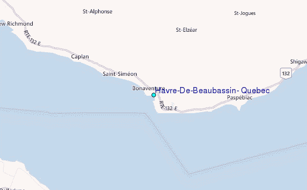
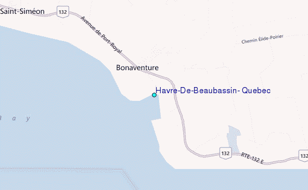
Use this relief map to navigate to tide stations, surf breaks and cities that are in the area of Havre-De-Beaubassin, Quebec.
Other Nearby Locations' tide tables and tide charts to Havre-De-Beaubassin, Quebec:
click location name for more details
 Surf breaks close to Havre-De-Beaubassin, Quebec:
|
||
|---|---|---|
| Closest surf break | Minutes | 255 mi |
| Second closest surf break | Backyards | 255 mi |
| Third closest surf break | Lawrencetown Right Point | 255 mi |
| Fourth closest surf break | Cow Bay | 256 mi |
| Fifth closest surf break | Lawrencetown Left Point | 256 mi |


 Nearest
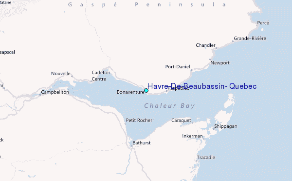