
| Distance / Altitude | Location | Report Date / Time | Live Weather | Wind | Gusts | Temp. | Visibility | Cloud |
|---|---|---|---|---|---|---|---|---|
| 60 km NNE / 391 m | Narssarssuaq Airport (Greenland) | 2025-12-26 07:20 local (2025/12/26 10:20 GMT) | - | fresh winds from the ENE (37 km/h at 70) | — | 10.0 | - mostly cloudy - | |
| 94 km SSE / 16 m | Angissoq (Greenland) | 2025-12-26 06:00 local (2025/12/26 09:00 GMT) | no report | wind obs. (13 kph from 310 degs) was rejected (- km/h at -) | 3°C | - | - | |
| 133 km WSW / 33 m | Nunarssuit (Greenland) | 2025-12-26 06:00 local (2025/12/26 09:00 GMT) | no report | wind obs. (13 kph from 150 degs) was rejected (- km/h at -) | 2°C | - | - | |
| 174 km ESE / 75 m | Ikerasassuaq (Prins Christian Sund) (Greenland) | 2025-12-26 06:00 local (2025/12/26 09:00 GMT) | - | light winds from the NW (7 km/h at 310) | — | - | - - - | |
| 243 km WNW / 36 m | Mittarfik Paamiut (Frederikshaab Lufthavn) (Greenland) | 2025-12-26 06:00 local (2025/12/26 09:00 GMT) | - | wind obs. (13 kph from 140 degs) was rejected (- km/h at -) | — | 23 | - - - | |
| 251 km NE / 42 m | Ikermiuarssuk (Greenland) | 2025-12-26 06:00 local (2025/12/26 09:00 GMT) | - | calm (4 km/h at 280) | — | - | - | |
| 312 km WNW / 22 m | Ukiivit (Greenland) | 2025-12-26 06:00 local (2025/12/26 09:00 GMT) | no report | wind obs. (9 kph from 180 degs) was rejected (- km/h at -) | 2°C | - | - | |
| 369 km E / 3 m | BUOY-44078 (Marine) | 2025-12-26 06:00 local (2025/12/26 09:00 GMT) | fresh winds from the SSE (36 km/h at 160) | 3°C | - | |||
| 485 km WNW / 213 m | Godthaabnuuk (Greenland) | 2025-12-26 07:20 local (2025/12/26 10:20 GMT) | continuous light rain | moderate winds from the SE (24 km/h at 140) | 1°C | 9 | broken - - | |
| 539 km NNE / 80 m | Ikermiit (Greenland) | 2025-12-26 06:00 local (2025/12/26 09:00 GMT) | - | calm (2 km/h at 310) | — | - | - - - |
| Contours: | Roads & Rivers: | Select a
tide station / surf break / city |
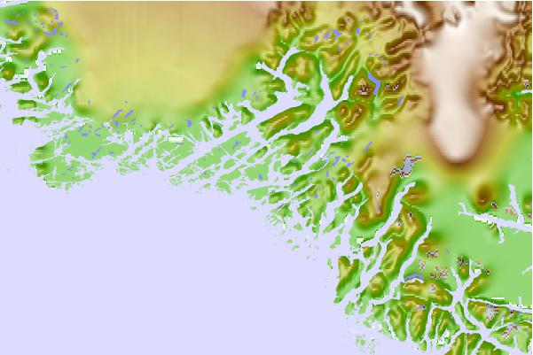
Use this relief map to navigate to tide stations, surf breaks and cities that are in the area of Julianehåb, Greenland (2).
Other Nearby Locations' tide tables and tide charts to Julianehab, Greenland (2):
click location name for more details
 Surf breaks close to Julianehab, Greenland (2):
|
||
|---|---|---|
| Closest surf break | Hafnir | 776 mi |
| Second closest surf break | Garur | 778 mi |
| Third closest surf break | Sandvik | 778 mi |
| Fourth closest surf break | Grindavik Antenas | 783 mi |
| Fifth closest surf break | Grindavik Lighthouse ( Hopsnesta) | 784 mi |


 Nearest