
| Distance / Altitude | Location | Report Date / Time | Live Weather | Wind | Gusts | Temp. | Visibility | Cloud |
|---|---|---|---|---|---|---|---|---|
| 43 km N / 220 m | Adana Sakirpasa (Turkey) | 2026-03-12 03:20 local (2026/03/12 00:20 GMT) | - | wind obs. (11 kph from 180 degs) was rejected (- km/h at -) | — | 10 | - - - | |
| 47 km N / 66 m | İncirlikHavalimani (Turkey) | 2026-03-12 03:00 local (2026/03/12 00:00 GMT) | - | light winds from the NNE (13 km/h at 20) | — | 0.0 | - clear - | |
| 71 km E / 119 m | Iskenderun (Turkey) | 2026-03-12 03:00 local (2026/03/12 00:00 GMT) | - | calm (4 km/h at 60) | — | 40 km | - clear - | |
| 73 km W / 3 m | Mersin (Turkey) | 2026-03-12 03:00 local (2026/03/12 00:00 GMT) | no report | calm (0 km/h at 0) | 14°C | 40 km | - no observation - | |
| 85 km ESE / 71 m | Hatay Havalimanı (Turkey) | 2026-03-12 03:00 local (2026/03/12 00:00 GMT) | no report | wind obs. (11 kph from 90 degs) was rejected (- km/h at -) | — | 0.0 | - - - | |
| 98 km NE / 86 m | Osmaniye (Turkey) | 2026-03-12 03:00 local (2026/03/12 00:00 GMT) | - | wind obs. (7 kph from 300 degs) was rejected (- km/h at -) | — | 20 | - no observation - | |
| 131 km WSW / 105 m | Silifke (Turkey) | 2026-03-12 03:00 local (2026/03/12 00:00 GMT) | - | calm (2 km/h at 260) | — | - | no observation | |
| 157 km E / 638 m | Kilis (Turkey) | 2026-03-12 03:00 local (2026/03/12 00:00 GMT) | no report | wind obs. (7 kph from 80 degs) was rejected (- km/h at -) | 8°C | 41 km | - no observation - | |
| 157 km WNW / 1044 m | Eregli/Konya (Turkey) | 2026-03-12 03:00 local (2026/03/12 00:00 GMT) | - | calm (4 km/h at 270) | — | 20 | - clear - | |
| 165 km NW / 1255 m | Nigde (Turkey) | 2026-03-12 03:00 local (2026/03/12 00:00 GMT) | no report | calm (0 km/h at 0) | -2°C | 47 km | - no observation - |
| Contours: | Roads & Rivers: | Select a
tide station / surf break / city |
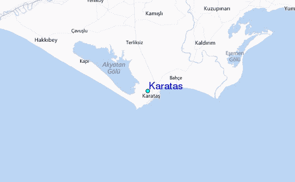
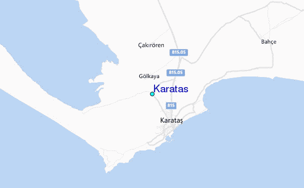
Use this relief map to navigate to tide stations, surf breaks and cities that are in the area of Karatas.
Other Nearby Locations' tide tables and tide charts to Karatas:
click location name for more details
 Surf breaks close to Karatas:
|
||
|---|---|---|
| Closest surf break | Stone-Tombs | 67 mi |
| Second closest surf break | Queen Victoria Beach | 145 mi |
| Third closest surf break | Sandy Beach - Chekka | 158 mi |
| Fourth closest surf break | Batroun or Colonel | 162 mi |
| Fifth closest surf break | Stegeo Beach | 167 mi |


 Nearest
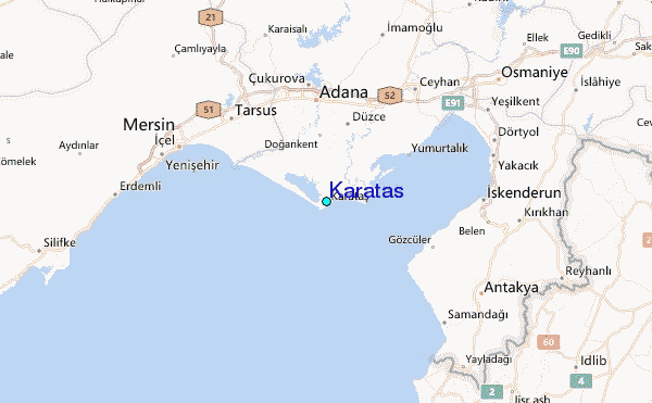