
| Distance / Altitude | Location | Report Date / Time | Live Weather | Wind | Gusts | Temp. | Visibility | Cloud |
|---|---|---|---|---|---|---|---|---|
| 16 km E / 33 m | Hamamatsu (Japan) | 2025-12-24 11:00 local (2025/12/24 02:00 GMT) | Continuous light rain | light winds from the ENE (13 km/h at 60) | 13°C | 39 km | no observation | |
| 22 km W / 11 m | Kō wx (Japan) | 2025-12-24 10:47 local (2025/12/24 01:47 GMT) | dry | calm (0 km/h at 15) | 13°C | - | - - 0 | |
| 23 km ENE / 67 m | Shimmiyakoda wx (Japan) | 2025-12-24 10:26 local (2025/12/24 01:26 GMT) | dry | calm (2 km/h at 122) | 13°C | - | - - 0 | |
| 41 km SW / 8 m | Irako (Japan) | 2025-12-24 11:00 local (2025/12/24 02:00 GMT) | Continuous light rain | light winds from the NNW (7 km/h at 340) | 11°C | 40 km | no observation | |
| 41 km S / 15 m | SHIP9717 (Marine) | 2025-12-24 09:00 local (2025/12/24 00:00 GMT) | strong winds from the WSW (40.68000000000001 km/h at 250) | 15°C | 3.2 km | |||
| 41 km S / 15 m | SHIP3595 (Marine) | 2025-12-24 09:00 local (2025/12/24 00:00 GMT) | strong winds from the WSW (40.68000000000001 km/h at 250) | 15°C | 3.2 km | |||
| 41 km S / 3 m | SHIP8525 (Marine) | 2025-12-24 09:00 local (2025/12/24 00:00 GMT) | strong winds from the WSW (41 km/h at 250) | 15°C | 3.7 | |||
| 60 km E / 135 m | Shizouka Airport (Japan) | 2025-12-24 10:00 local (2025/12/24 01:00 GMT) | Shower light rain shower | light winds from the N (7 km/h at 1) | 11°C | 9.0 | few scattered broken | |
| 64 km ESE / 47 m | Omaezaki Cape (Japan) | 2025-12-24 11:00 local (2025/12/24 02:00 GMT) | Intermittent moderate rain | light winds from the NE (19 km/h at 40) | 13°C | 3.3 km | - no observation - | |
| 66 km E / 3 m | Sumiyoshi wx (Japan) | 2025-12-24 11:12 local (2025/12/24 02:12 GMT) | dry | calm (5 km/h at 16) | 12°C | - | - - 0 |
| Contours: | Roads & Rivers: | Select a
tide station / surf break / city |
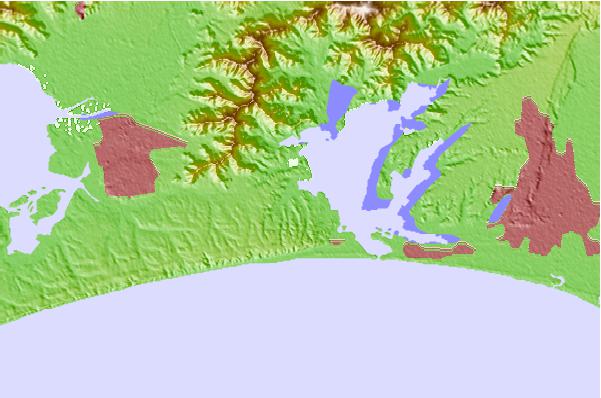
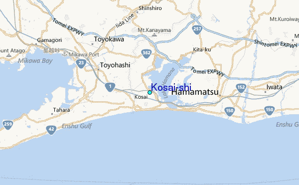
Use this relief map to navigate to tide stations, surf breaks and cities that are in the area of Kosai-shi.
Other Nearby Locations' tide tables and tide charts to Kosai-shi:
click location name for more details
 Surf breaks close to Kosai-shi:
|
||
|---|---|---|
| Closest surf break | Akabane Long Beach | 21 mi |
| Second closest surf break | Susuki | 38 mi |
| Third closest surf break | Katahama | 39 mi |
| Fourth closest surf break | Omaezaki | 39 mi |
| Fifth closest surf break | Suruga Bay | 40 mi |


 Nearest