
| Distance / Altitude | Location | Report Date / Time | Live Weather | Wind | Gusts | Temp. | Visibility | Cloud |
|---|---|---|---|---|---|---|---|---|
| 26 km WSW / 167 m | Hofu Airport (Japan) | 2025-12-26 17:17 local (2025/12/26 08:17 GMT) | Shower light snow | moderate winds from the WNW (24 km/h at 290) | 3°C | 10.0 | few broken | |
| 38 km ENE / 401 m | Iwakuni Marine Corps Air Station Airport (Japan) | 2025-12-26 16:56 local (2025/12/26 07:56 GMT) | Shower - in the vicinity | calm (0 km/h at 28) | 3°C | 10.0 | few few | |
| 39 km W / 18 m | Yamaguchi (Japan) | 2025-12-26 18:00 local (2025/12/26 09:00 GMT) | Freezing rain | light winds from the WSW (11 km/h at 250) | 2°C | 40 km | no observation | |
| 49 km WSW / 20 m | Imamurakita wx (Japan) | 2025-12-26 18:06 local (2025/12/26 09:06 GMT) | - | calm (0 km/h at 134) | 1°C | - | - - 0 | |
| 53 km WSW / 475 m | Yamaguchi/Ube Airport (Japan) | 2025-12-26 17:00 local (2025/12/26 08:00 GMT) | Dry and partly cloudy | light winds from the NW.(Wind varies from 280 to 030 degs) (11 km/h at 320) | 2°C | 10.0 | few scattered | |
| 57 km NE / 117 m | Roppommatsu wx (Japan) | 2025-12-26 18:11 local (2025/12/26 09:11 GMT) | - | calm (2 km/h at 304) | 1°C | - | - - 0 | |
| 60 km S / 446 m | Oita Airport (Japan) | 2025-12-26 17:00 local (2025/12/26 08:00 GMT) | Shower light snow | light winds from the NW (15 km/h at 320) | 3°C | 10.0 | few scattered broken | |
| 61 km WNW / 7 m | Hagi (Japan) | 2025-12-26 18:00 local (2025/12/26 09:00 GMT) | Freezing rain | light winds from the NW (17 km/h at 310) | 3°C | 40 km | no observation | |
| 71 km ENE / 12 m | Kure (Japan) | 2025-12-26 18:00 local (2025/12/26 09:00 GMT) | - | light winds from the W (17 km/h at 280) | 4°C | 40 km | no observation | |
| 73 km NE / 239 m | Hiroshima (Japan) | 2025-12-26 17:00 local (2025/12/26 08:00 GMT) | - | light winds from the N (11 km/h at 350) | 4°C | 40 km | no observation |
| Contours: | Roads & Rivers: | Select a
tide station / surf break / city |
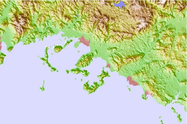
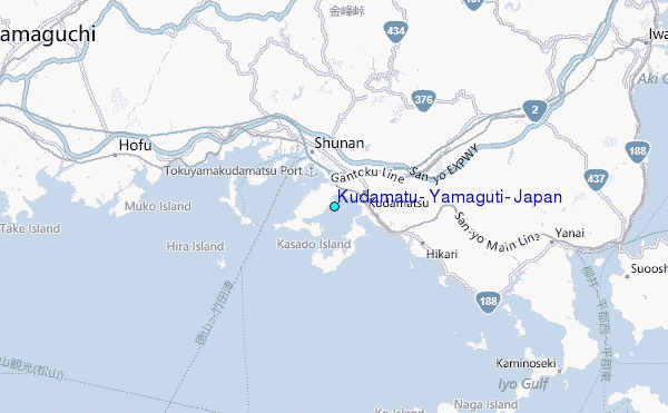
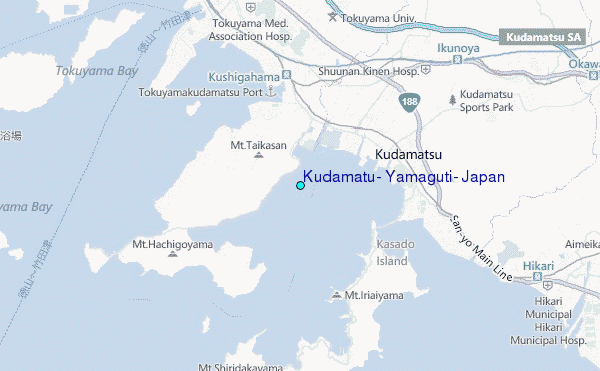
Use this relief map to navigate to tide stations, surf breaks and cities that are in the area of Kudamatu, Yamaguti, Japan.
Other Nearby Locations' tide tables and tide charts to Kudamatu, Yamaguti, Japan:
click location name for more details
 Surf breaks close to Kudamatu, Yamaguti, Japan:
|
||
|---|---|---|
| Closest surf break | Dragons Leaf | 85 mi |
| Second closest surf break | Kodogawa | 107 mi |
| Third closest surf break | Fukuoka | 108 mi |
| Fourth closest surf break | Niyodo Rivermouth | 111 mi |
| Fifth closest surf break | Okuragahama | 111 mi |


 Nearest
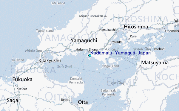