
| Distance / Altitude | Location | Report Date / Time | Live Weather | Wind | Gusts | Temp. | Visibility | Cloud |
|---|---|---|---|---|---|---|---|---|
| 13 km S / 17 m | Bonilla Island Airport (British columbia) | 2026-05-24 15:00 local (2026/05/24 22:00 GMT) | - | near gales from the SE (59 km/h at 130) | — | 0.0 | ||
| 15 km S / 14 m | Bonilla Island (Aut)- BC (Canada) | 2026-05-24 14:00 local (2026/05/24 21:00 GMT) | no report | - (- km/h at -) | 11°C | - | - - - | |
| 29 km S / 15 m | SHIP3605 (Marine) | 2026-05-24 16:00 local (2026/05/24 23:00 GMT) | - (- km/h at -) | — | - km | |||
| 63 km NNE / 6 m | Holland Rock- BC (Canada) | 2026-05-24 15:00 local (2026/05/24 22:00 GMT) | no report | calm (4 km/h at 20) | 11°C | - | - - - | |
| 74 km N / 216 m | Lucy Island Airport (British Columbia) | 2026-05-24 15:00 local (2026/05/24 22:00 GMT) | - | strong winds from the ESE (43 km/h at 110) | 7°C | 0.0 | ||
| 58 km S / 15 m | SHIP5793 (Marine) | 2026-05-24 15:00 local (2026/05/24 22:00 GMT) | - (- km/h at -) | — | - km | |||
| 58 km S / 15 m | SHIP2823 (Marine) | 2026-05-24 15:00 local (2026/05/24 22:00 GMT) | - (- km/h at -) | — | - km | |||
| 58 km S / 15 m | SHIP4150 (Marine) | 2026-05-24 15:00 local (2026/05/24 22:00 GMT) | - (- km/h at -) | — | - km | |||
| 63 km NNE / 6 m | Holland Rock- BC (Canada) | 2026-05-24 15:00 local (2026/05/24 22:00 GMT) | no report | calm (4 km/h at 20) | 11°C | - | - - - | |
| 74 km N / 216 m | Lucy Island Airport (British Columbia) | 2026-05-24 15:00 local (2026/05/24 22:00 GMT) | - | strong winds from the ESE (43 km/h at 110) | 7°C | 0.0 |
| Contours: | Roads & Rivers: | Select a
tide station / surf break / city |
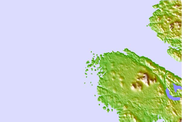
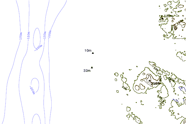
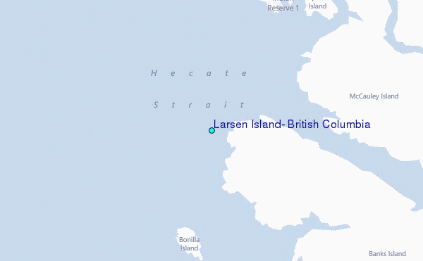
Use this relief map to navigate to tide stations, surf breaks and cities that are in the area of Larsen Island, British Columbia.
Other Nearby Locations' tide tables and tide charts to Larsen Island, British Columbia:
click location name for more details
 Surf breaks close to Larsen Island, British Columbia:
|
||
|---|---|---|
| Closest surf break | Tow Hill Beach | 59 mi |
| Second closest surf break | Lepus Beach (Haida-Gwaii) | 108 mi |
| Third closest surf break | Nootka Island (Calvin Bay) | 317 mi |
| Fourth closest surf break | Tofino (North Chestermans Beach) | 370 mi |
| Fifth closest surf break | South Chesterman Beach | 371 mi |


 Nearest
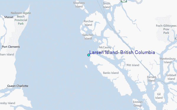