
| Distance / Altitude | Location | Report Date / Time | Live Weather | Wind | Gusts | Temp. | Visibility | Cloud |
|---|---|---|---|---|---|---|---|---|
| 29 km SSW / 8 m | Iles DE LA Madeleine- Que (Canada) | 2026-02-13 05:00 local (2026/02/13 09:00 GMT) | - | strong winds from the WNW (44 km/h at 300) | -4°C | - | - no observation - | |
| 31 km SSW / 194 m | Iles de la madel Airport (Quebec) | 2026-02-13 04:00 local (2026/02/13 08:00 GMT) | - | strong winds from the NW (43 km/h at 310) | -3°C | 0.0 | ||
| 103 km SSE / 42 m | Pleasant Bay (Canada) | 2026-02-13 05:00 local (2026/02/13 09:00 GMT) | - | wind obs. (21 kph from 218 degs) was rejected (- km/h at -) | -4°C | - | - - 0 | |
| 105 km SE / 10 m | Bay St. Lawrence (Canada) | 2026-02-13 04:50 local (2026/02/13 08:50 GMT) | - | moderate winds from the WNW (24 km/h at 295) | -2°C | - | - - 0 | |
| 107 km SSE / 303 m | Pleasant Bay wx (Canada) | 2026-02-13 05:10 local (2026/02/13 09:10 GMT) | - | calm (0 km/h at 340) | -6°C | - | - - 0 | |
| 110 km SE / 439 m | North Mountain Airport (Nova scotia) | 2026-02-13 04:00 local (2026/02/13 08:00 GMT) | - | wind obs. (50 kph from 0 degs) was rejected (- km/h at -) | -6°C | 0.0 | ||
| 110 km SE / 22 m | Aspy Bay wx (Canada) | 2026-02-13 05:03 local (2026/02/13 09:03 GMT) | - | moderate winds from the WNW (26 km/h at 288) | -2°C | - | - - 0 | |
| 111 km SE / 75 m | Big Intervale (Canada) | 2026-02-13 04:38 local (2026/02/13 08:38 GMT) | - | wind obs. (14 kph from 175 degs) was rejected (- km/h at -) | -4°C | - | - - 0 | |
| 113 km ESE / 27 m | ST Paul Island (Aut)- NS (Canada) | 2026-02-13 04:00 local (2026/02/13 08:00 GMT) | - | wind obs. (29 kph from 240 degs) was rejected (- km/h at -) | — | - | - | |
| 115 km SE / 3 m | South Harbour (Canada) | 2026-02-13 05:16 local (2026/02/13 09:16 GMT) | - | wind obs. (16 kph from 233 degs) was rejected (- km/h at -) | -3°C | - | - - 0 |
| Contours: | Roads & Rivers: | Select a
tide station / surf break / city |
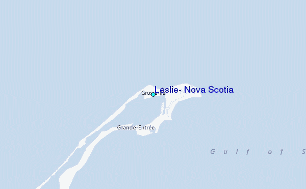
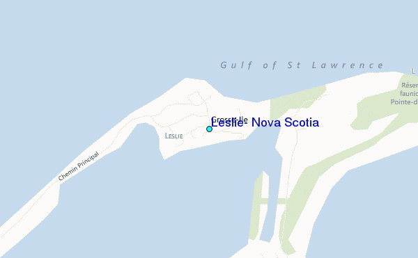
Use this relief map to navigate to tide stations, surf breaks and cities that are in the area of Leslie, Nova Scotia.
Other Nearby Locations' tide tables and tide charts to Leslie, Nova Scotia:
click location name for more details
 Surf breaks close to Leslie, Nova Scotia:
|
||
|---|---|---|
| Closest surf break | Ingonish Beach | 86 mi |
| Second closest surf break | Kennington Cove | 139 mi |
| Third closest surf break | Michaud Point | 147 mi |
| Fourth closest surf break | Martinique | 218 mi |
| Fifth closest surf break | Lawrencetown Left Point | 223 mi |


 Nearest
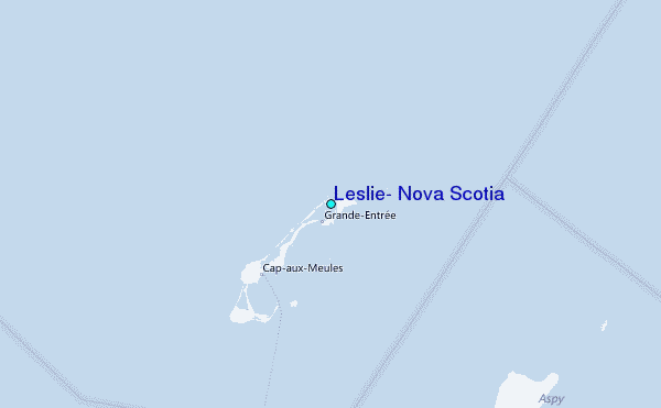