
| Distance / Altitude | Location | Report Date / Time | Live Weather | Wind | Gusts | Temp. | Visibility | Cloud |
|---|---|---|---|---|---|---|---|---|
| 39 km NNE / 194 m | La Scie, Newfoundland (Canada) | 2026-07-26 03:30 local (2026/07/26 06:00 GMT) | - | wind obs. (14 kph from 230 degs) was rejected (- km/h at -) | — | - | - - - | |
| 71 km S / 103 m | Badger (Aut)- Nfld (Canada) | 2026-07-26 03:30 local (2026/07/26 06:00 GMT) | no report | light winds from the SW (11 km/h at 220) | 24°C | - | - - - | |
| 81 km E / 92 m | Twillingate (Aut)- Nfld (Canada) | 2026-07-26 03:30 local (2026/07/26 06:00 GMT) | no report | fresh winds from the SW (29 km/h at 220) | 21°C | - | - - - | |
| 82 km E / 207 m | Twillingate Airport (Newfoundland) | 2026-07-26 04:30 local (2026/07/26 07:00 GMT) | - | light winds from the WSW (9 km/h at 240) | 16°C | 0.0 | ||
| 115 km SW / 217 m | Deer Lake Airport (Newfoundland) | 2026-07-26 04:30 local (2026/07/26 07:00 GMT) | - | calm (0 km/h at 0) | — | 24 | ||
| 116 km SW / 22 m | Deer Lake Airport (Canada) | 2026-07-26 04:30 local (2026/07/26 07:00 GMT) | no report | - (- km/h at -) | 23°C | - | - - - | |
| 122 km SE / 151 m | Gander Int l A- Nfld (Canada) | 2026-07-26 03:30 local (2026/07/26 06:00 GMT) | no report | - (- km/h at -) | 23°C | - | - | |
| 122 km SE / 68 m | Gander International Airport (Canada) | 2026-07-26 05:30 local (2026/07/26 08:00 GMT) | no report | moderate winds from the SW (25 km/h at 230) | 23°C | - | - | |
| 122 km SE / 217 m | Gander International Airport (Newfoundland) | 2026-07-26 04:30 local (2026/07/26 07:00 GMT) | Dry and partly cloudy | light winds from the W (15 km/h at 280) | 16°C | 32 | scattered | |
| 125 km N / 216 m | Englee Airport (Newfoundland) | 2026-07-26 04:30 local (2026/07/26 07:00 GMT) | - | light winds from the WNW (11 km/h at 290) | 17°C | 0.0 |
| Contours: | Roads & Rivers: | Select a
tide station / surf break / city |


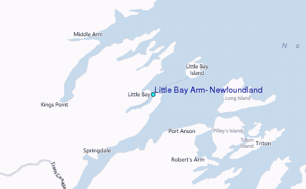
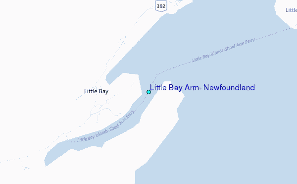
Use this relief map to navigate to tide stations, surf breaks and cities that are in the area of Little Bay Arm, Newfoundland.
Other Nearby Locations' tide tables and tide charts to Little Bay Arm, Newfoundland:
click location name for more details
 Surf breaks close to Little Bay Arm, Newfoundland:
|
||
|---|---|---|
| Closest surf break | Ingonish Beach | 291 mi |
| Second closest surf break | Kennington Cove | 321 mi |
| Third closest surf break | Michaud Point | 356 mi |
| Fourth closest surf break | Martinique | 480 mi |
| Fifth closest surf break | Lawrencetown Left Point | 489 mi |


 Nearest
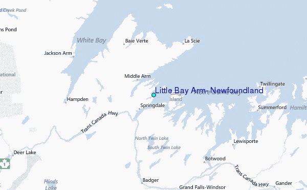