
| Distance / Altitude | Location | Report Date / Time | Live Weather | Wind | Gusts | Temp. | Visibility | Cloud |
|---|---|---|---|---|---|---|---|---|
| 18 km WNW / 18 m | Tokerau Beach wx (New Zealand) | 2026-02-22 11:37 local (2026/02/21 22:37 GMT) | dry | light winds from the SW (11 km/h at 235) | 21°C | - | - - 0 | |
| 24 km SW / 50 m | Kaitaia Airport (New Zealand) | 2026-02-22 12:00 local (2026/02/21 23:00 GMT) | Clear skies | light winds from the SW (15 km/h at 220) | 21°C | 20 km | no observation | |
| 46 km SE / 151 m | Kerikeri Aero Automatic Weather Station (New Zealand) | 2026-02-22 12:00 local (2026/02/21 23:00 GMT) | Clear skies | light winds from the SSW (19 km/h at 200) | 20°C | 10 km | no observation | |
| 49 km N / 15 m | ASCATC174E35S (Marine) | 2026-02-22 10:14 local (2026/02/21 21:14 GMT) | light winds from the S (18 km/h at 184) | — | - km | |||
| 56 km N / 15 m | ASCATB174E34S (Marine) | 2026-02-22 09:39 local (2026/02/21 20:39 GMT) | light winds from the S (19 km/h at 175) | — | - km | |||
| 63 km N / 15 m | ASCATC174E34S (Marine) | 2026-02-22 10:14 local (2026/02/21 21:14 GMT) | light winds from the S (19 km/h at 186) | — | - km | |||
| 68 km N / 15 m | ASCATC173E34S (Marine) | 2026-02-22 10:14 local (2026/02/21 21:14 GMT) | moderate winds from the S (20 km/h at 191) | — | - km | |||
| 71 km N / 15 m | ASCATB173E34S (Marine) | 2026-02-22 09:39 local (2026/02/21 20:39 GMT) | moderate winds from the S (20 km/h at 171) | — | - km | |||
| 80 km E / 15 m | ASCATB174E35S (Marine) | 2026-02-22 09:39 local (2026/02/21 20:39 GMT) | moderate winds from the S (22 km/h at 188) | — | - km | |||
| 92 km E / 15 m | ASCATB175E35S (Marine) | 2026-02-22 09:39 local (2026/02/21 20:39 GMT) | moderate winds from the SSW (22 km/h at 192) | — | - km |
| Contours: | Roads & Rivers: | Select a
tide station / surf break / city |
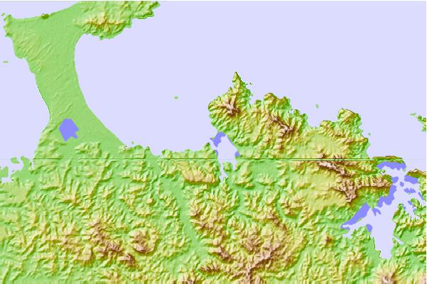
Use this relief map to navigate to tide stations, surf breaks and cities that are in the area of Mangonui, New Zealand.
Other Nearby Locations' tide tables and tide charts to Mangonui, New Zealand:
click location name for more details
 Surf breaks close to Mangonui, New Zealand:
|
||
|---|---|---|
| Closest surf break | Coopers Beach | 1 mi |
| Second closest surf break | Fairway Reef | 4 mi |
| Third closest surf break | Taipa Bay | 4 mi |
| Fourth closest surf break | Motukahakaha and Paradise Bay | 7 mi |
| Fifth closest surf break | Taupo Bay | 11 mi |


 Nearest