
| Distance / Altitude | Location | Report Date / Time | Live Weather | Wind | Gusts | Temp. | Visibility | Cloud |
|---|---|---|---|---|---|---|---|---|
| 49 km SE / 19 m | PoolsIsland-Nfld (Canada) | 2025-12-19 01:30 local (2025/12/19 05:00 GMT) | - | wind obs. (18 kph from 180 degs) was rejected (- km/h at -) | — | - | - no observation - | |
| 64 km W / 207 m | Twillingate Airport (Newfoundland) | 2025-12-19 00:30 local (2025/12/19 04:00 GMT) | - | fresh winds from the WSW (31 km/h at 250) | -2°C | 0.0 | ||
| 66 km W / 92 m | Twillingate(Aut)-Nfld (Canada) | 2025-12-19 01:30 local (2025/12/19 05:00 GMT) | - | fresh winds from the SW (29 km/h at 220) | — | - | - no observation - | |
| 71 km SSW / 217 m | Gander International Airport (Newfoundland) | 2025-12-19 00:30 local (2025/12/19 04:00 GMT) | Dry and cloudy | moderate winds from the WSW (20 km/h at 240) | -3°C | 24 | overcast | |
| 72 km SSW / 151 m | Gander Int l A- Nfld (Canada) | 2025-12-19 01:30 local (2025/12/19 05:00 GMT) | - | - (- km/h at -) | — | - | - | |
| 72 km SSW / 151 m | Gander International Airport (Canada) | 2025-12-19 01:30 local (2025/12/19 05:00 GMT) | - | moderate winds from the SW (25 km/h at 230) | — | - | - - - | |
| 100 km S / 216 m | Terra Nova Airport (Newfoundland) | 2025-12-19 00:30 local (2025/12/19 04:00 GMT) | - | light winds from the SW (7 km/h at 230) | -4°C | 0.0 | ||
| 107 km SE / 30 m | Bonavista (Canada) | 2025-12-19 01:30 local (2025/12/19 05:00 GMT) | - | strong winds from the SW (43 km/h at 220) | — | - | - no observation - | |
| 133 km W / 140 m | La Scie, Newfoundland (Canada) | 2025-12-19 01:30 local (2025/12/19 05:00 GMT) | - | light winds from the SW (14 km/h at 230) | — | - | - no observation - | |
| 162 km SW / 103 m | Badger(Aut)-Nfld (Canada) | 2025-12-19 00:30 local (2025/12/19 04:00 GMT) | - | light winds from the SW (11 km/h at 220) | — | - | - no observation - |
| Contours: | Roads & Rivers: | Select a
tide station / surf break / city |
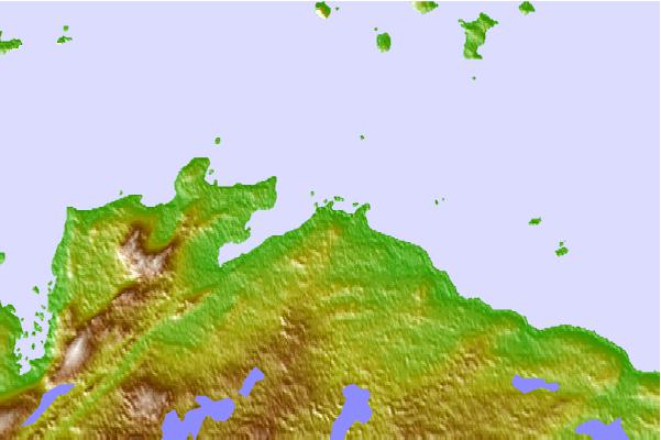
Use this relief map to navigate to tide stations, surf breaks and cities that are in the area of Musgrave Harbour, Newfoundland.
Other Nearby Locations' tide tables and tide charts to Musgrave Harbour, Newfoundland:
click location name for more details
 Surf breaks close to Musgrave Harbour, Newfoundland:
|
||
|---|---|---|
| Closest surf break | Ingonish Beach | 355 mi |
| Second closest surf break | Kennington Cove | 376 mi |
| Third closest surf break | Michaud Point | 413 mi |
| Fourth closest surf break | Martinique | 543 mi |
| Fifth closest surf break | Lawrencetown Left Point | 552 mi |


 Nearest