
| Distance / Altitude | Location | Report Date / Time | Live Weather | Wind | Gusts | Temp. | Visibility | Cloud |
|---|---|---|---|---|---|---|---|---|
| 68 km SSE / 17 m | Hagiwara wx (Japan) | 2026-07-10 09:05 local (2026/07/10 00:05 GMT) | dry | calm (0 km/h at 262) | 35°C | - | - - 0 | |
| 69 km SSE / 474 m | Toyama Airport (Japan) | 2026-07-10 08:00 local (2026/07/09 23:00 GMT) | - | light winds from the S.(Wind varies from 120 to 210 degs) (11 km/h at 170) | — | 0.0 | ||
| 74 km SSE / 69 m | Sasazu wx (Japan) | 2026-07-10 07:41 local (2026/07/09 22:41 GMT) | dry | wind obs. (8 kph from 80 degs) was rejected (- km/h at -) | 28°C | - | - - 0 | |
| 106 km NNE / 15 m | hy2b138E38N (Marine) | 2026-07-10 06:30 local (2026/07/09 21:30 GMT) | light winds from the S (11 km/h at 190) | — | - km | |||
| 107 km S / 217 m | Komatsu Airport (Japan) | 2026-07-10 08:00 local (2026/07/09 23:00 GMT) | - | light winds from the WNW.(Wind varies from 210 to 350 degs) (6 km/h at 290) | 27°C | 10.0 | few | |
| 111 km W / 15 m | hy2b136E38N (Marine) | 2026-07-10 06:30 local (2026/07/09 21:30 GMT) | moderate winds from the SSW (24 km/h at 195) | — | - km | |||
| 119 km WSW / 15 m | hy2b136E37N (Marine) | 2026-07-10 06:30 local (2026/07/09 21:30 GMT) | moderate winds from the S (25 km/h at 185) | — | - km | |||
| 125 km E / 19 m | Nishiki wx (Japan) | 2026-07-10 08:05 local (2026/07/09 23:05 GMT) | dry | calm (0 km/h at 160) | 29°C | - | - - 0 | |
| 128 km ESE / 423 m | Uematsu wx (Japan) | 2026-07-10 09:18 local (2026/07/10 00:18 GMT) | - | calm (2 km/h at 229) | 29°C | - | - - 0 | |
| 129 km NW / 15 m | hy2b137E38N (Marine) | 2026-07-10 06:30 local (2026/07/09 21:30 GMT) | light winds from the SSW (14 km/h at 205) | — | - km |
| Contours: | Roads & Rivers: | Select a
tide station / surf break / city |
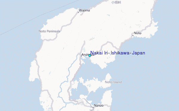
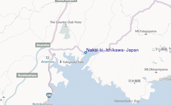
Use this relief map to navigate to tide stations, surf breaks and cities that are in the area of Nakai Iri, Ishikawa, Japan.
Other Nearby Locations' tide tables and tide charts to Nakai Iri, Ishikawa, Japan:
click location name for more details
 Surf breaks close to Nakai Iri, Ishikawa, Japan:
|
||
|---|---|---|
| Closest surf break | Akabane Long Beach | 183 mi |
| Second closest surf break | Sakawa River | 185 mi |
| Third closest surf break | Hanamizu River | 186 mi |
| Fourth closest surf break | Oiso Jetty | 186 mi |
| Fifth closest surf break | Suruga Bay | 187 mi |


 Nearest
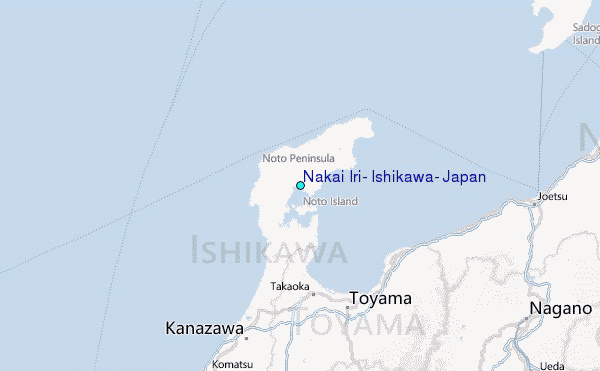